


Von der Kirche in Trins über die Forststraße bzw. den Herrensteig zum Padasterhaus und weiter zum Padasterkogel.
Aufgrund akuter "Kuhangst" meiner Begleitung haben wir den ersten Teil des Herrensteigs umlaufen und haben hier die Forststraße genutzt. Braucht man im Normalfall natürlich nicht.
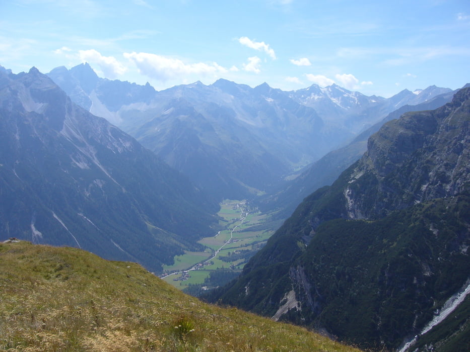
Es lohnt sich am Padasterkogel noch ein paar Hundert Meter weiterzugehen. Dort hat man einen wunderschönen Ausblick auf Trins und das vordere Gschnitztal.
Tour gallery

Tour map and elevation profile
Minimum height 1214 m
Maximum height 2287 m
More about the tour author

|
klixx |
Comments

Start und Ziel ist die Kirche in Trins. Man kann auch die ersten paar Meter noch mit dem Auto auf einen kleinen Wanderparkplatz fahren und das Auto dort abstellen.
GPS tracks
Trackpoints-
GPX / Garmin Map Source (gpx) download
-
TCX / Garmin Training Center® (tcx) download
-
CRS / Garmin Training Center® (crs) download
-
Google Earth (kml) download
-
G7ToWin (g7t) download
-
TTQV (trk) download
-
Overlay (ovl) download
-
Fugawi (txt) download
-
Kompass (DAV) Track (tk) download
-
Track data sheet (pdf) download
-
Original file of the author (gpx) download
More about the tour author
|
|
klixx |
Add to my favorites
Remove from my favorites
Edit tags
Open track
My score
Rate