Login

Forgot your login?

Cookies have to be accepted!
Your browser's cookie functionality is disabled. Please enable this functionality.

Not a member yet?

Register now
Login

Available for registred users only

Log in to use this feature.

Forgot your login?

Cookies have to be accepted!
Your browser's cookie functionality is disabled. Please enable this functionality.

Not a member yet?

Register now
Filter
Categories
Advanced filters
  • Distance (km)
  • Height
Save filters Reset filter

TrackRank

QRCode

Technical data

Distance42,2 km Height2891 m Way down2898 m Duration08:00 h:m Date05.10.2015
Scores Author Landscape Fun factor Fitness Technique

Statistics

417 Views Scores 20 Downloads Average
Rate
  • Track data sheet
  • Directions
  • Downloads

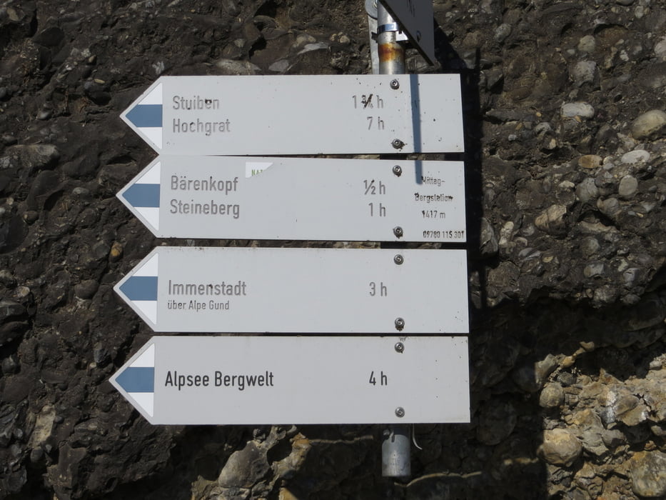
die beliebte Gratwanderung im Allgäu von Immenstadt über Mittag zum Hochgrat als Trailrun

...und gleich wieder zurück! ;-)

Für normales Wandern werden ab Mittag Bergstation bis Hochgrat 7h angegeben
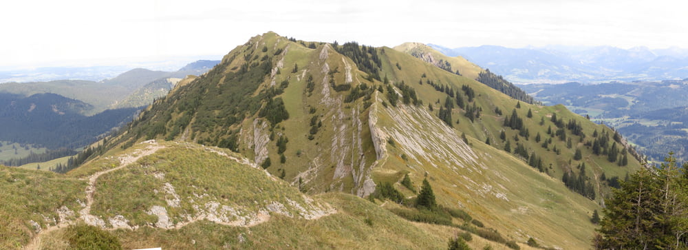
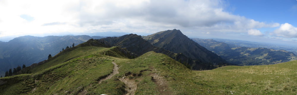
 

Tour gallery

Tour map and elevation profile

  • Open Street Map
  • Google
Minimum height 727 m Maximum height 1838 m Detailed view

More about the tour author

Mathis_muc
Member since 2008

Send private message

Comments

GPS tracks

Trackpoints
  • GPX / Garmin Map Source (gpx) download
  • TCX / Garmin Training Center® (tcx) download
  • CRS / Garmin Training Center® (crs) download
  • Google Earth (kml) download
  • G7ToWin (g7t) download
  • TTQV (trk) download
  • Overlay (ovl) download
  • Fugawi (txt) download
  • Kompass (DAV) Track (tk) download
  • Track data sheet (pdf) download
  • Original file of the author (gpx) download

More about the tour author

Mathis_muc
Member since 2008

Send private message
Share track
Add to my favorites
Remove from my favorites
Edit tags
My score
Rate
Track: Nagelfluhkette ab Immenstadt hin&her
Type: Mountain hiking
Distance: 42,2 km
Evaluated on:
Duration:
Day(s)
Hour(s)
Minute(s)
Score: Landscape Fun factor Fitness Technique