Login

Forgot your login?

Cookies have to be accepted!
Your browser's cookie functionality is disabled. Please enable this functionality.

Not a member yet?

Register now
Login

Available for registred users only

Log in to use this feature.

Forgot your login?

Cookies have to be accepted!
Your browser's cookie functionality is disabled. Please enable this functionality.

Not a member yet?

Register now
Filter
Categories
Advanced filters
  • Distance (km)
  • Height
Save filters Reset filter

TrackRank

QRCode

Technical data

Distance6,0 km Height236 m Way down237 m Duration00:00 h:m Date15.10.2015
Scores Author Landscape Fun factor Fitness Technique

Statistics

980 Views Scores 46 Downloads Average
Rate
  • Track data sheet
  • Directions
  • Downloads

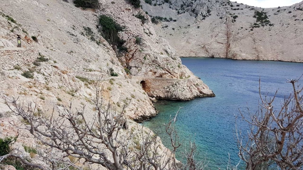
Nette kleine Wanderung im Nationalpark Velebit. Das kroatische Dorf Jablanac ist der Ausgangspunkt zu dieser romantischen Bucht - Zavratnica.


Further information at

http://www.satcom.at/jablanac-zavratnica/

Tour gallery

Tour map and elevation profile

  • Open Street Map
  • Google
Minimum height -10 m Maximum height 153 m Detailed view

More about the tour author

GarminSalzburg
Member since 2008

Send private message

Comments

GPS tracks

Trackpoints
  • GPX / Garmin Map Source (gpx) download
  • TCX / Garmin Training Center® (tcx) download
  • CRS / Garmin Training Center® (crs) download
  • Google Earth (kml) download
  • G7ToWin (g7t) download
  • TTQV (trk) download
  • Overlay (ovl) download
  • Fugawi (txt) download
  • Kompass (DAV) Track (tk) download
  • Track data sheet (pdf) download
  • Original file of the author (gpx) download

More about the tour author

GarminSalzburg
Member since 2008

Send private message
Share track
Add to my favorites
Remove from my favorites
Edit tags
My score
Rate
Track: Sehr schöne Bucht zum Wandern - in Kroatien Zavratnica
Type: Hiking
Distance: 6,0 km
Evaluated on:
Duration:
Day(s)
Hour(s)
Minute(s)
Score: Landscape Fun factor Fitness Technique