Login

Forgot your login?

Cookies have to be accepted!
Your browser's cookie functionality is disabled. Please enable this functionality.

Not a member yet?

Register now
Login

Available for registred users only

Log in to use this feature.

Forgot your login?

Cookies have to be accepted!
Your browser's cookie functionality is disabled. Please enable this functionality.

Not a member yet?

Register now
Filter
Categories
Advanced filters
  • Distance (km)
  • Height
Save filters Reset filter

TrackRank

QRCode

Technical data

Distance18,3 km Height1689 m Way down1648 m Duration05:00 h:m Date30.12.2015
Scores Author Landscape Fun factor Fitness Technique

Statistics

297 Views Scores 29 Downloads Average
Rate
  • Track data sheet
  • Directions
  • Downloads

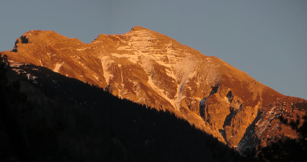
Meine Idealtour zur Soiernspitze ab Mittenwald

Aufstieg über Signalkopf

Höhenweg zur Soiernspitze hin und her

Abstieg ab Feldernkreuz (Schafkehre) zur Ochsenalm

Alternativ kann man auch über Ochsenalm aufsteigen, eine Variante mit Abstieg über Signalkopf ist aber für Trailrunner eher nervig (1.000 Kehren)

Zeit gilt für zügiges Trainrunning, Wander mal 3!


Tour map and elevation profile

  • Open Street Map
  • Google
Minimum height 903 m Maximum height 2285 m Detailed view

More about the tour author

Mathis_muc
Member since 2008

Send private message

Comments

GPS tracks

Trackpoints
  • GPX / Garmin Map Source (gpx) download
  • TCX / Garmin Training Center® (tcx) download
  • CRS / Garmin Training Center® (crs) download
  • Google Earth (kml) download
  • G7ToWin (g7t) download
  • TTQV (trk) download
  • Overlay (ovl) download
  • Fugawi (txt) download
  • Kompass (DAV) Track (tk) download
  • Track data sheet (pdf) download
  • Original file of the author (gpx) download

More about the tour author

Mathis_muc
Member since 2008

Send private message
Share track
Add to my favorites
Remove from my favorites
Edit tags
My score
Rate
Track: Soiernspitze ab Mittenwald - Idealtour ;-)
Type: Mountain hiking
Distance: 18,3 km
Evaluated on:
Duration:
Day(s)
Hour(s)
Minute(s)
Score: Landscape Fun factor Fitness Technique