Login

Forgot your login?

Cookies have to be accepted!
Your browser's cookie functionality is disabled. Please enable this functionality.

Not a member yet?

Register now
Login

Available for registred users only

Log in to use this feature.

Forgot your login?

Cookies have to be accepted!
Your browser's cookie functionality is disabled. Please enable this functionality.

Not a member yet?

Register now
Filter
Categories
Advanced filters
  • Distance (km)
  • Height
Save filters Reset filter

TrackRank

QRCode

Technical data

Distance21,5 km Height460 m Way down455 m Duration04:30 h:m Date31.01.2016
Scores Author Landscape Fun factor Fitness Technique

Statistics

947 Views Scores 9 Downloads Average
Rate
  • Track data sheet
  • Directions
  • Downloads

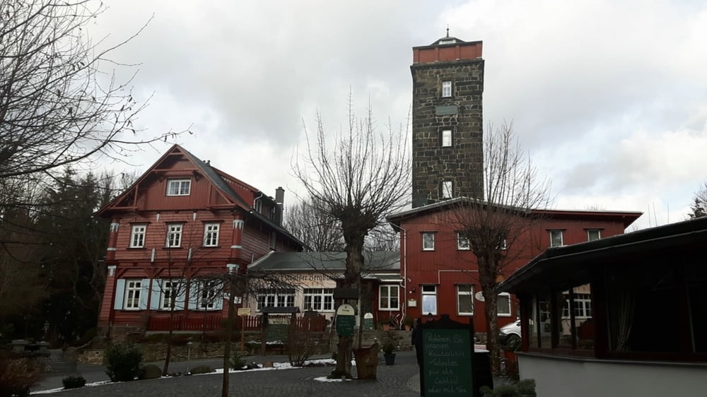
Wanderung von Bautzen zum Mönchswalder Berg mit einer schönen Bergbaude, welche zur Einkehr sehr gut geeignet ist, und zurück nach Bautzen. Eine Wandertour von Bautzen in das schöne Oberlausitzer Bergland.


Further information at

http://moenchswalder.de

Tour map and elevation profile

  • Open Street Map
  • Google
Minimum height 181 m Maximum height 455 m Detailed view

More about the tour author

jens_100
Member since 2016

Send private message

Comments

Die Tour startet von Bautzen ab dem Parkhaus auf der Äußeren Lauenstraße. Alternativ ist gegenüber in der Gaststätte Zollhaus eine preiswerte Übernachtung möglich.


GPS tracks

Trackpoints
  • GPX / Garmin Map Source (gpx) download
  • TCX / Garmin Training Center® (tcx) download
  • CRS / Garmin Training Center® (crs) download
  • Google Earth (kml) download
  • G7ToWin (g7t) download
  • TTQV (trk) download
  • Overlay (ovl) download
  • Fugawi (txt) download
  • Kompass (DAV) Track (tk) download
  • Track data sheet (pdf) download
  • Original file of the author (gpx) download

More about the tour author

jens_100
Member since 2016

Send private message
Share track
Add to my favorites
Remove from my favorites
Edit tags
My score
Rate
Track: Wanderung von Bautzen zum Mönchswalder Berg und zurück
Type: Hiking
Distance: 21,5 km
Evaluated on:
Duration:
Day(s)
Hour(s)
Minute(s)
Score: Landscape Fun factor Fitness Technique