


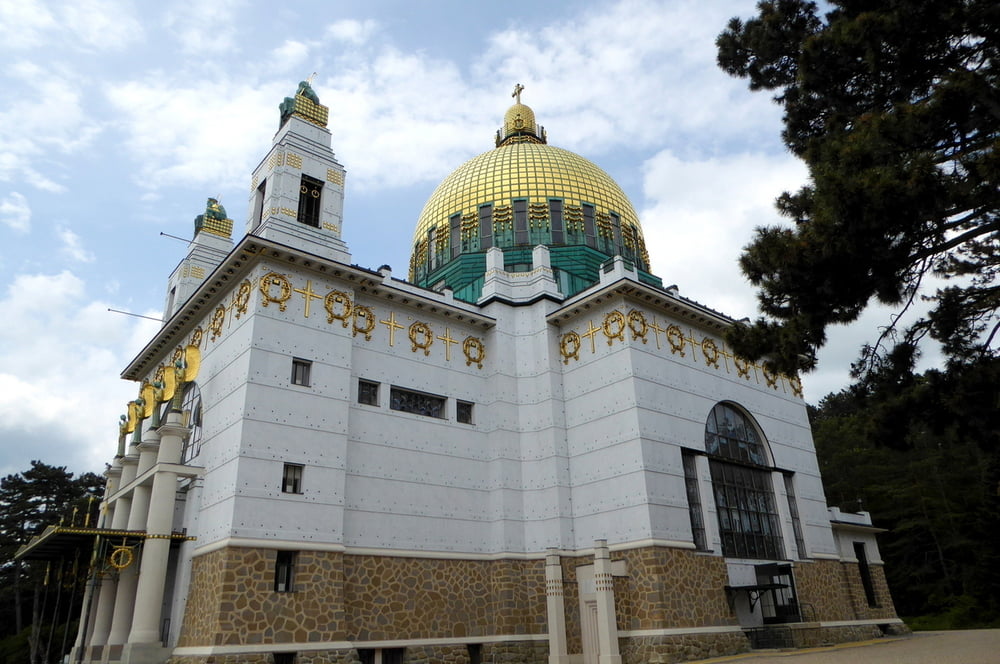
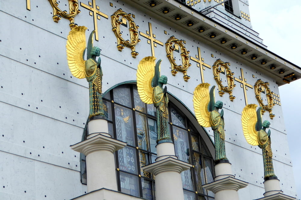
Wir wandern von der Endhaltestelle der U3 in Ottakring vorbei am Friedhof Ottakring und der Feuerwache Am Steinhof, sehen danach in der Nähe den Beobachtugnsturm der Jubiläumswarte, steigen ab zum Erholungsgebiet Steinhof und gehen dort zu der Otto-Wagner-Kirche, eines der bedeutendsten Bauwerke des Wiener Jugendstils. Von dort wandern wir nach Hutteldorf, von wo wir mit der Staßenbahn Nr. 13 in die Wiener Innenstadt zurückfahren
Further information at
https://www.wien.gv.at/umwelt/wald/freizeit/wandern/wege/wanderweg4a.htmlTour gallery


Tour map and elevation profile
Minimum height 245 m
Maximum height 473 m
More about the tour author
|
|
horst1508 |
Comments

s. o.
GPS tracks
Trackpoints-
GPX / Garmin Map Source (gpx) download
-
TCX / Garmin Training Center® (tcx) download
-
CRS / Garmin Training Center® (crs) download
-
Google Earth (kml) download
-
G7ToWin (g7t) download
-
TTQV (trk) download
-
Overlay (ovl) download
-
Fugawi (txt) download
-
Kompass (DAV) Track (tk) download
-
Track data sheet (pdf) download
-
Original file of the author (gpx) download
More about the tour author
|
|
horst1508 |
Add to my favorites
Remove from my favorites
Edit tags
Open track
My score
Rate