


Eine Schnuppertour im Frühjahr.
Ein Blick in die Welt der Winterberge.
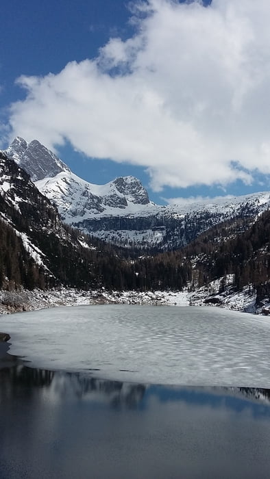
Berchtesgadener-Loferer und Leoganger Berge auf einen Rundblick.
Tolle Hochebene mit vielen Almen und Hütten.
Zu jeder Jahreszeit ein Genuß
Von Pürzlbach auf der Forststraße ca. 1 Std. 15 Min. zur Kallbrunnalm.
Tour gallery

Tour map and elevation profile
Minimum height 1109 m
Maximum height 1542 m
More about the tour author
|
|
Kletterwolf |
Comments

Von Lofer in Richtung Saalfelden fahren.
In Weisbach dann nach links Richtung Hirschbichl.
Es geht den Berg hinauf. An der beschilderten Abzweigung Pürzlbach rechts abbiegen und bis zum Parkplatz Pürzlbach fahren.
Parkautomat. 2€ für 1 Tag.
GPS tracks
Trackpoints-
GPX / Garmin Map Source (gpx) download
-
TCX / Garmin Training Center® (tcx) download
-
CRS / Garmin Training Center® (crs) download
-
Google Earth (kml) download
-
G7ToWin (g7t) download
-
TTQV (trk) download
-
Overlay (ovl) download
-
Fugawi (txt) download
-
Kompass (DAV) Track (tk) download
-
Track data sheet (pdf) download
-
Original file of the author (gpx) download
More about the tour author
|
|
Kletterwolf |
Add to my favorites
Remove from my favorites
Edit tags
Open track
My score
Rate