


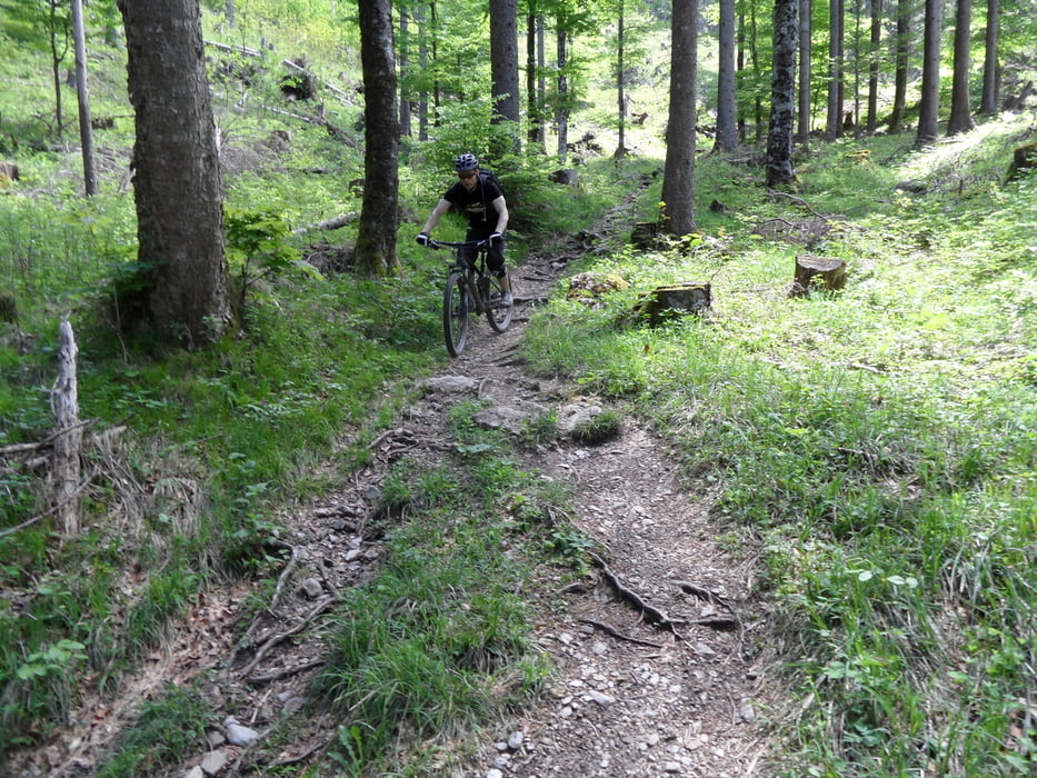
Tour von Feldkirch zum Sorajasattel unterhalb der 3Schwestern (Güterweg, zuletzt 100hm S2 Auffahrt). Hinunter recht streng S2-S3, also anspruchsvoll. Nach ca. 200hm kommt die Gafadurahütte. Danach wurzelige technische Abfahrt nach Planken. Bei Nässe noch schwerer, besser nur an trockenen Tagen. In Planken dann den S2 Wanderweg nach Nendeln.
Ein interessantes Gebiet für Liebhaber schwerer Abfahrten.
Man kann auch von Liechtensteiner Seite auf Fahrweg zur Gafadurahütte radeln. Bei Ourtdooractive gibt es eine Tour über Oberplanken ins Tal. Der Weg hier geht über Nendeln und ist einfacher und komplett fahrbar. Über Oberplanken bin ich markant gelaufen (10min).
Tour gallery
Tour map and elevation profile
Minimum height 457 m
Maximum height 1631 m
More about the tour author
|
|
skyhopper |
Comments
parken in Feldkirch nahe Autobahnabfahrt, Strasse heißt Felsenau Frastanz
GPS tracks
Trackpoints-
GPX / Garmin Map Source (gpx) download
-
TCX / Garmin Training Center® (tcx) download
-
CRS / Garmin Training Center® (crs) download
-
Google Earth (kml) download
-
G7ToWin (g7t) download
-
TTQV (trk) download
-
Overlay (ovl) download
-
Fugawi (txt) download
-
Kompass (DAV) Track (tk) download
-
Track data sheet (pdf) download
-
Original file of the author (gpx) download
More about the tour author
|
|
skyhopper |
Add to my favorites
Remove from my favorites
Edit tags
Open track
My score
Rate
Super Trailtour
Die Auffahrt ist teilweise Recht steil zumeist aber in angenehmer Steigung.
Highlight sind die Trails vom Sarijasattel bis ins Tal.
Danke für den Track
Hat richtig Spaß gemacht.