


Die Tour wird im Taschenbuch "Wandern um Jena, Südliche Umgebung", erschienen im Jenzig-Verlag Jena, als Wanderung 4 ausführlich beschrieben.
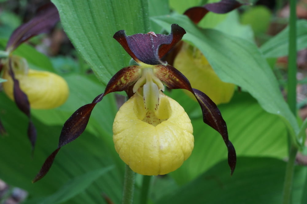
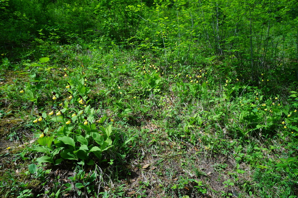
Besonders empfehlenswert ist die Wanderung zur Zeit der Orchideenblüte. Am Hang oberhalb von Großkochberg sind ganze Frauenschuhwiesen zu bewundern.
In diesem Bereich ist dann auch die Begegnung mit anderen Wanderern wahrscheinlicher, während man auf dem Rest des Weges allein unterwegs ist.
Tour gallery
Tour map and elevation profile
Minimum height 355 m
Maximum height 531 m
More about the tour author
|
|
aussie1248 |
Comments

Anreise per KFZ über Kahla-Reinstädt-Wittersroda
ca. 1,7km hinter dem Ortsausgang Wittersroda in Richtung Lengefeld links auf einen Feldweg abbiegen
Parkmöglichkeit auf oder nahe der Brücke
GPS tracks
Trackpoints-
GPX / Garmin Map Source (gpx) download
-
TCX / Garmin Training Center® (tcx) download
-
CRS / Garmin Training Center® (crs) download
-
Google Earth (kml) download
-
G7ToWin (g7t) download
-
TTQV (trk) download
-
Overlay (ovl) download
-
Fugawi (txt) download
-
Kompass (DAV) Track (tk) download
-
Track data sheet (pdf) download
-
Original file of the author (gpx) download
More about the tour author
|
|
aussie1248 |
Add to my favorites
Remove from my favorites
Edit tags
Open track
My score
Rate