


Unsere Rundtour startet am Parkplatz beim Sunset Point und kombiniert den Queens Garden Loop, den Peekaboo Loop und den Rim Trail. Da der Rim Trail zwischen Bryce Point und Inspiration Point gesperrt war haben wir für diese Etappe den Bus genommen.
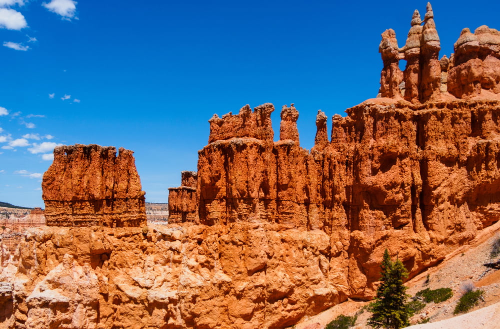
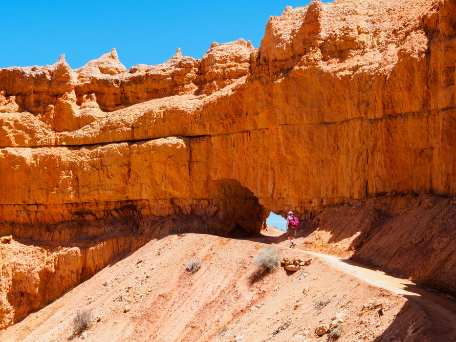
Queens Garden Loop und der Rim Trail sind leicht zu laufen. Der Peekaboo Loop ist um einiges wilder. Geländer gibt es i.d.R. nur an den großen Aussichtspunkten am Rim. Der Weg ist aber immer so breit, dass man nicht direkt an der Kante laufen muss. Der Peekaboo Loob ist leider auch für Reiter zugelassen. Wir sind allerdings nur den Hinterlassenschaften der Vierbeiner begegnet.
Further information at
https://www.nps.gov/brca/index.htmTour gallery


Tour map and elevation profile
Minimum height 2245 m
Maximum height 2521 m
More about the tour author
|
|
ds5 |
Comments

Fee: The entrance fee to Bryce Canyon National Park is $30 per private vehicle. Bryce Canyon accepts current Federal Recreational Lands Passes for admission to the park.From the North:
Take I-15 south to UT-20 (exit 95). Travel east on UT-20 to US-89. Follow US-89 south to UT-12. Travel east on UT-12 to UT-63. Take UT-63 south to Bryce Canyon National Park. The visitor center sits 1 mile inside the park boundary.
From the South through Zion National Park:
Take I-15 north to UT-9 (exit 16). Follow UT-9 east through Zion National Park to US-89. Travel north on US-89 to UT-12. Go east on UT-12 to UT-63. Take UT-63 south to Bryce Canyon National Park. The visitor center sits 1 mile inside the park boundary.
Take I-15 north to exit 59. Go east on 200 north, then south on Main Street to Center Street/UT-14. Travel east on UT-14 to US-89. Go north on US-89 to UT-12. Follow UT-12 east to UT-63. Take UT-63 south to Bryce Canyon National Park. The visitor center sits 1 mile inside the park boundary. This is a very scenic route during the summer months and early fall.
From the South through Bear (Dog) Valley:
Take I-15 north to UT-20 (exit 95). Go east on UT-20 to US-89. Follow US-89 south to UT-12. Travel east on UT-12 to UT-63. Take UT-63 south to Bryce Canyon National Park. The visitor center sits 1 mile inside the park boundary.
Public Transportation:
Public transportation to the park is not available.
GPS tracks
Trackpoints-
GPX / Garmin Map Source (gpx) download
-
TCX / Garmin Training Center® (tcx) download
-
CRS / Garmin Training Center® (crs) download
-
Google Earth (kml) download
-
G7ToWin (g7t) download
-
TTQV (trk) download
-
Overlay (ovl) download
-
Fugawi (txt) download
-
Kompass (DAV) Track (tk) download
-
Track data sheet (pdf) download
-
Original file of the author (gpx) download
More about the tour author
|
|
ds5 |
Add to my favorites
Remove from my favorites
Edit tags
Open track
My score
Rate