


Entspricht in etwa der Wanderung Nr. 8 aus dem Rother-Wanderführer.
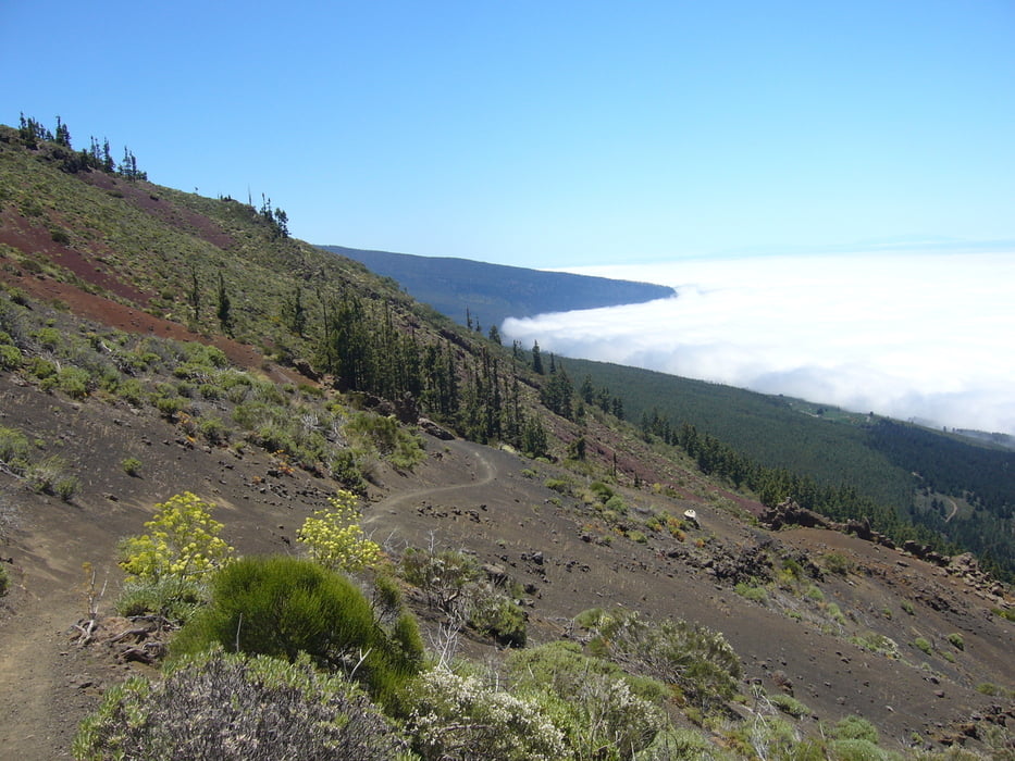
Ab der Forellenzuchtfarm oberhalb von Aguamansa einem alten Pilgerweg folgen. Es geht quasi permanent bergauf. Erst durch Kieferwald, dann durch Lavagestein. Hier ist der Untergrund großteils rutschig, so dass das Vorankommen etwas mühsam ist. Belohnt wird man durch grandiose Ausblicke auf den Teide, auf Puerto de la Cruz und das Orotavatal.
Der Rückweg entspricht dem Hinweg.
Tour gallery

Tour map and elevation profile
Minimum height 1075 m
Maximum height 2045 m
More about the tour author

|
klixx |
Comments

Von Puerto de la Cruz immer Richtung Teide/Aguamansa bis zur Forellenzuchtfarm in einer Kurve.
GPS tracks
Trackpoints-
GPX / Garmin Map Source (gpx) download
-
TCX / Garmin Training Center® (tcx) download
-
CRS / Garmin Training Center® (crs) download
-
Google Earth (kml) download
-
G7ToWin (g7t) download
-
TTQV (trk) download
-
Overlay (ovl) download
-
Fugawi (txt) download
-
Kompass (DAV) Track (tk) download
-
Track data sheet (pdf) download
-
Original file of the author (gpx) download
More about the tour author
|
|
klixx |
Add to my favorites
Remove from my favorites
Edit tags
Open track
My score
Rate