


Wir sind mit dem Bus zur Haltestelle Kugelmühle gefahren, die nur ca 500 m vom Ausgangspunkt, dem Gasthaus Almbachklamm entfernt ist. Die Schlucht ist wildromantisch und mit zahlreichen Treppen, Stegen und auch Tunnels versehen. Vom Gasthaus der Almbachklamm kommt man zur Kasse, an der auch Eintritt verlangt wird. Die Treppen und Stege ermöglichen das Wandern durch die Schlucht. Wir sind bis zum ehemaligen Triftwehr Theresienklause gewandert, wo man die Wahl hat, entweder nach Maria Gern zum Gasthof Dürrlehen oder nach Ettenberg zum Mesnerwirt, zu wandern.
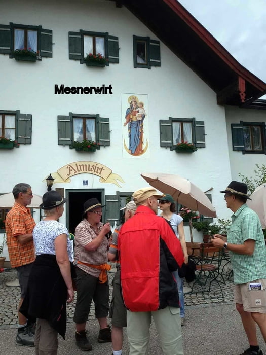
Leider waren beim Mesnerwirt Filmarbeiten für den Tag angesagt, sodass wir unsere Einkehr auf das Ende der Tour verschieben mussten in den Gasthof Almbachklamm. Eine sehr schöne Wanderung, die allerdings am Ende der Tour von Ettenberg hinunter ins Tal steil abfällt und gutes Stehvermögen abverlangt.
Tour gallery


Tour map and elevation profile
Minimum height 487 m
Maximum height 818 m
More about the tour author
|
|
SiegfriedTheurer |
Comments

Mit dem Bus vom Bahnhof Berchtesgaden in Richtung Marktschellenberg und bei der Haltestelle Kugelmühle aussteigen.
GPS tracks
Trackpoints-
GPX / Garmin Map Source (gpx) download
-
TCX / Garmin Training Center® (tcx) download
-
CRS / Garmin Training Center® (crs) download
-
Google Earth (kml) download
-
G7ToWin (g7t) download
-
TTQV (trk) download
-
Overlay (ovl) download
-
Fugawi (txt) download
-
Kompass (DAV) Track (tk) download
-
Track data sheet (pdf) download
-
Original file of the author (gpx) download
More about the tour author
|
|
SiegfriedTheurer |
Add to my favorites
Remove from my favorites
Edit tags
Open track
My score
Rate