


Anspruchsvolle MTB Tour auf die Paganella bei Trento
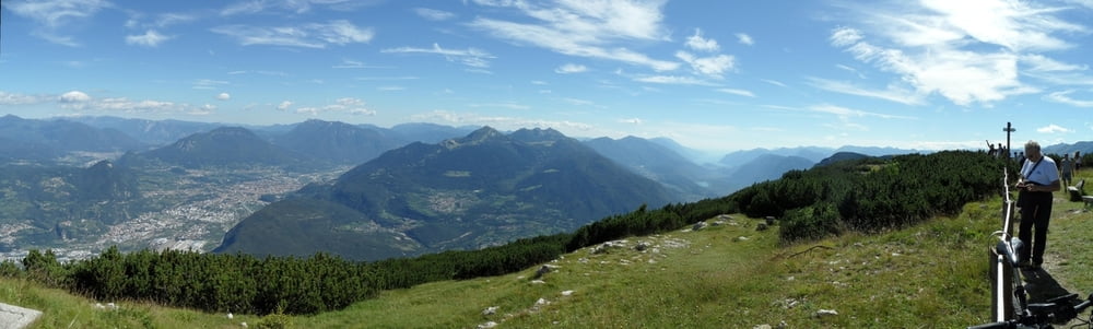
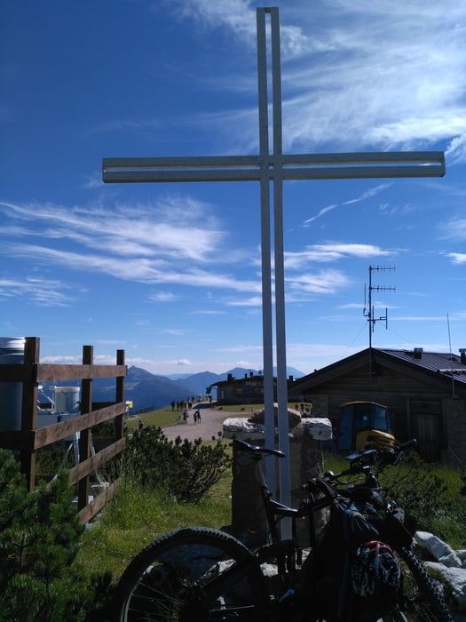
Der Berg ist mir auf der Fahrt nach Bassano schon oft aufgefallen, ein riesen Felsklotz vor Trento mit Lift und Antennen drauf. Einen Bikepark mit 5Liften gibt es (Link).
Start in Mezzolombardo neben einem Supermarkt. Auf Passstraße bis Santèl 1033m, ab da weitgehend auf Güterweg zum Gipfel, die letzen 300m etwas steiler (aber mit Willen fahrbar).
Alternativ Bikepark-Lift auf die Paganella ab Santel. Am Gipfel top Rundsicht, der Gardasee ist nicht mehr weit.
Abfahrt weitgehend auf S1-S3Trails, in Santel nochmal 350hm hinauf zur Endabfahrt (kann man aus Zeitgründen weglassen), Abfahrt trifft auf Auffahrt . Auf 680m sind wir rechts abgebogen und einen ausgesetzten Wanderweg in steilem Gelände hinunter. Der Weg ging (80%fahrbar), war aber immer wieder mit kurzen Laufpassagen und engen Kurven verbunden (S3). Geht man stattdessen ein klein wenig weiter hinauf - statt rechts abzubiegen - kommt man paralllel zur Strasse ins Tal. Der Weg ist mit Sicherheit einfacher.
Further information at
http://www.paganella.net/sito/news.php?id=News%20Dolomiti%20Paganella%20Bike|431Tour gallery


Tour map and elevation profile
Minimum height 225 m
Maximum height 2124 m
More about the tour author
|
|
skyhopper |
Comments

Parken in Mezzolombardo
GPS tracks
Trackpoints-
GPX / Garmin Map Source (gpx) download
-
TCX / Garmin Training Center® (tcx) download
-
CRS / Garmin Training Center® (crs) download
-
Google Earth (kml) download
-
G7ToWin (g7t) download
-
TTQV (trk) download
-
Overlay (ovl) download
-
Fugawi (txt) download
-
Kompass (DAV) Track (tk) download
-
Track data sheet (pdf) download
-
Original file of the author (gpx) download
More about the tour author
|
|
skyhopper |
Add to my favorites
Remove from my favorites
Edit tags
Open track
My score
Rate