


Tourendatum: 22.08.2016
Tourensteckbrief:
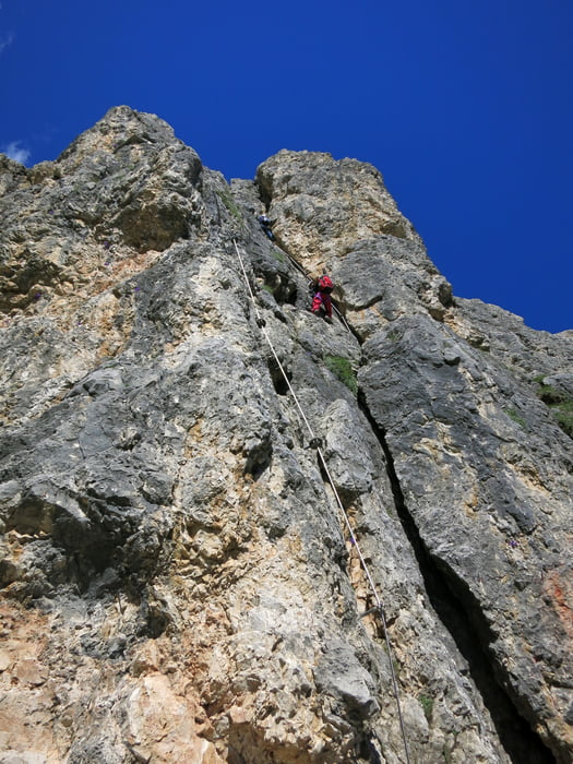
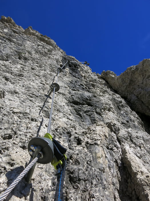
Schöner, mittelschwerer Klettersteig (C/D), gut als Halbtagestour machbar;
Zeiten: zum Einstieg ca. 1h; Klettersteig ca. 1,5h; Abstieg ca. knappe Stunde
Starthöhe ca. 1985m;
Höchster Punkt ca. 2550m
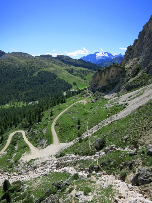
Der Steig ist sehr gut versichert; Abstieg auf gerölligem Weg von einer Scharte zurück;
Eine weitere Beschreibung erspare ich mir hier, das es genügend Führerliteratur und Informationen im Internet gibt.
Further information at
https://photos.google.com/share/AF1QipO_sCY6fvurujpRulCffskfhjj-44mz0iLfyHr81OKr79PvLpR5sDd_JXacTjfRoQ?key=czlfaVlITE9Md2ljM0pYRHR1ZkE5OS1oaXN3NDN3Tour gallery
Tour map and elevation profile
Minimum height 1990 m
Maximum height 2520 m
More about the tour author
|
|
Eimy |
Comments

PP ca. 2km unterhalb des Falzaregopasses Richtung Cortina (ca. 1985m bei aufgelassener Wirtschaft)
GPS tracks
Trackpoints-
GPX / Garmin Map Source (gpx) download
-
TCX / Garmin Training Center® (tcx) download
-
CRS / Garmin Training Center® (crs) download
-
Google Earth (kml) download
-
G7ToWin (g7t) download
-
TTQV (trk) download
-
Overlay (ovl) download
-
Fugawi (txt) download
-
Kompass (DAV) Track (tk) download
-
Track data sheet (pdf) download
-
Original file of the author (gpx) download
More about the tour author
|
|
Eimy |
Add to my favorites
Remove from my favorites
Edit tags
Open track
My score
Rate