
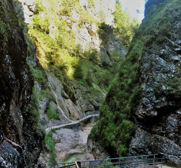

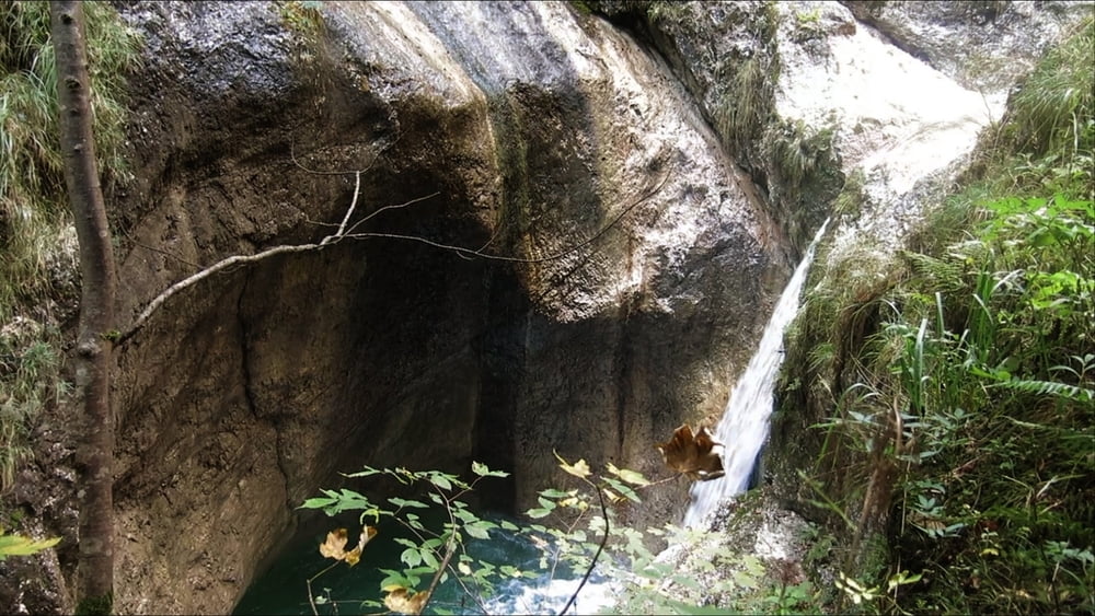
Vor dem Gasthaus gibt es reichliche Informationen über die Kugelmühle, direkt danach Eingang zur Almbachklamm. Es geht über Steige, Treppen und Stege in der engen Klamm stetig bergan. Gegen Ende an einer Abzweigung noch kurz links weiter zum hohen "Sulzer Wasserfall", 114m Fallhöhe!!
Zurück zum Abzweig, links im Wald kräftig z.T. über Stufen weiter aufwärts. Aus dem Wald heraus blickt man direkt auf die Wallfahrtskirche Ettenberg. Die kleine Kirche ist prächtig ausgestattet. Direkt davor- wir sind schließlich in Bayern- das Gasthaus "Mesnerwirt". Dahinter thront der Untersberg.
Der Abstieg über den Gatterlweg ist recht steil und steinig (lose)- festes Schuhwerk!
HINWEIS zum Video:
Mit Mozilla Firefox und Flash- Player Plugin startet das Video direkt.
Andernfalls verwendet ihr in eurem Browser den Link:
https://youtu.be/ihBI1w2J-eI
Tour gallery


Tour map and elevation profile
Minimum height 495 m
Maximum height 831 m
More about the tour author
|
|
heinz-57 |
Comments

Von Berchtesgaden auf B305 Richtung Marktschellenberg, an derAbzweigung "Roßfeld/ Obersalzberg" vorbei, nach ca. 1km links ab zur Almbachklamm/ Kugelmühle. Es gibt hier links gleich einen Parkplatz, nach 300m einen weiteren direkt am Gasthaus/ Klammbeginn.
GPS tracks
Trackpoints-
GPX / Garmin Map Source (gpx) download
-
TCX / Garmin Training Center® (tcx) download
-
CRS / Garmin Training Center® (crs) download
-
Google Earth (kml) download
-
G7ToWin (g7t) download
-
TTQV (trk) download
-
Overlay (ovl) download
-
Fugawi (txt) download
-
Kompass (DAV) Track (tk) download
-
Track data sheet (pdf) download
-
Original file of the author (gpx) download
More about the tour author
|
|
heinz-57 |
Add to my favorites
Remove from my favorites
Edit tags
Open track
My score
Rate