


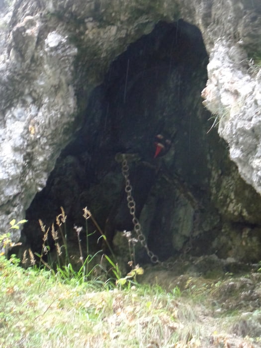
Vom Parkplatz die Forststraße hinauf bis zur Abzweigung. Dem Steig in die Schlucht folgen. Von der Brücke schöne Blicke in die Klamm. Aus der Nische grüßt der Teufel!
Zurück zur Forststraße und weiter aufwärts bis zur Kitzgrabenhütte (Abzweigung zum Brunnkopf). Abwärts in den Aschergraben und im Tal links Richtung Waidring. Bei der Schäferaukapelle rechts den Kreuzweg, dann links den Bach aufwärts bis zum Tennisplatz.
Gegenüber der Parkplatz und Weg in die Weißbachschlucht. Bei der Abzweigung links aufwärts nach Oberweißbach. Über die Rechensauhöfe hinunter nach St. Adolari und links zurück zum Ausgangspunkt.
Further information at
https://www.kitzbueheler-alpen.com/de/pillerseetal/urlaub-skifahren-langlaufen.htmlTour gallery
Tour map and elevation profile
Minimum height 754 m
Maximum height 1236 m
More about the tour author

|
JoHangler |
Comments

Von Waidring Richtung Fieberbrunn bis kurz vor St. Adolari. Links ist der Parkplatz.
GPS tracks
Trackpoints-
GPX / Garmin Map Source (gpx) download
-
TCX / Garmin Training Center® (tcx) download
-
CRS / Garmin Training Center® (crs) download
-
Google Earth (kml) download
-
G7ToWin (g7t) download
-
TTQV (trk) download
-
Overlay (ovl) download
-
Fugawi (txt) download
-
Kompass (DAV) Track (tk) download
-
Track data sheet (pdf) download
-
Original file of the author (gpx) download
More about the tour author
|
|
JoHangler |
Add to my favorites
Remove from my favorites
Edit tags
Open track
My score
Rate