


Landschaftlich Reizvolle Tour rund um Geislingen
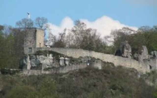
Die Tour beginnt in Geislingen und führt uns auf Trails steil hinauf zur Ruine Helfenstein. Ungeübte Fahrer müssen hier ein Stück schieben. Oben bietet sich die Einkehr im alten Burgkeller an.
Weiter geht es auf Forst und Waldwegen zur DAV Hütte der Sektion Brenztal. Von hier gelangt man durchs Roggental zurück nach Geislingen
Further information at
http://www.alpencrosstouren.infoTour gallery
Tour map and elevation profile
Minimum height 415 m
Maximum height 687 m
More about the tour author

|
Schwabe |
Comments

Geislingen ( an der Steige ) erreicht man recht verkehrsgünstig über die A 8 / E 52 Ausfahrt Mühlhausen und dann über Gosbach, Bad Ditzenbach, Deggingen, Bad Überkingen auf B 466. Eine weitere Variante ist die B 10 von Ulm oder Stuttgart kommend.
GPS tracks
Trackpoints-
GPX / Garmin Map Source (gpx) download
-
TCX / Garmin Training Center® (tcx) download
-
CRS / Garmin Training Center® (crs) download
-
Google Earth (kml) download
-
G7ToWin (g7t) download
-
TTQV (trk) download
-
Overlay (ovl) download
-
Fugawi (txt) download
-
Kompass (DAV) Track (tk) download
-
Track data sheet (pdf) download
-
Original file of the author (gpx) download
More about the tour author
|
|
Schwabe |
Add to my favorites
Remove from my favorites
Edit tags
Open track
My score
Rate