


Wir starteten in Wattweiler am Sportplatz und besuchten gleich zu Beginn den Raulstein der ein Kalktuffriff ist.
Als ich ihn im Sommer suchte war er so überwuchert dass ich ihn nicht sah. Nun war er freigelegt.
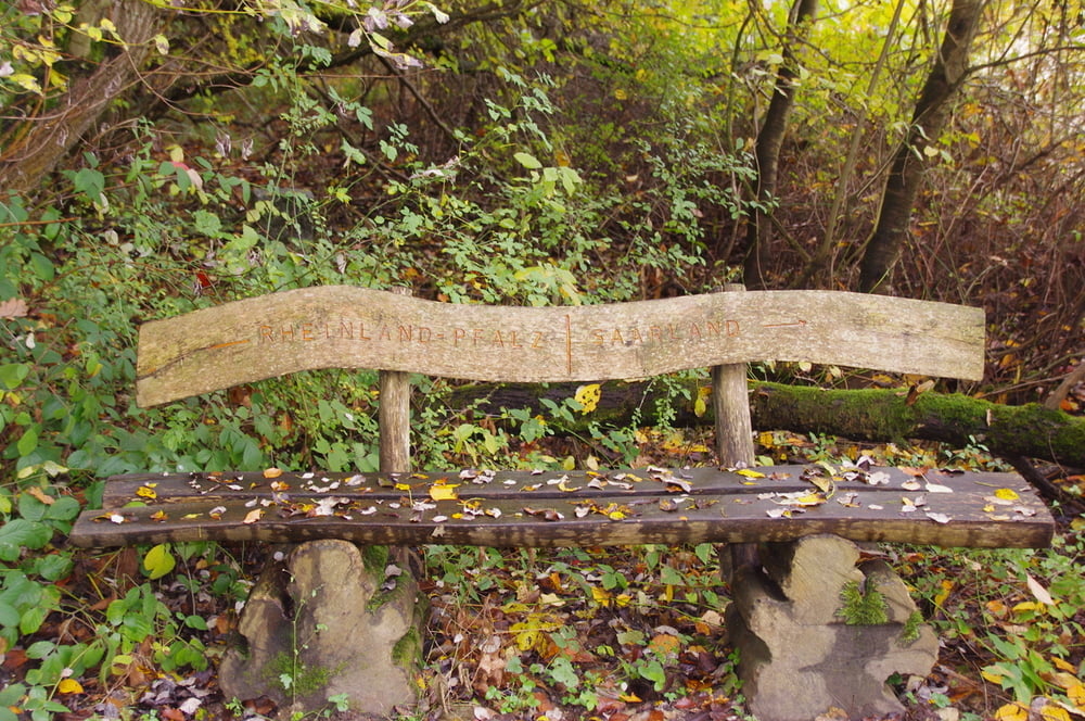
Wir erklommen die Höhe nicht auf dem Hauptweg und wanderten anschließend bei schöner Aussicht bis wir oberhalb von Webenheim die Aussicht über das Bliesgau geniessen konnten. Auf den gut ausgebauten Feldwegen wanderten wir zur Landesgrenze zu Rheinland-Pfalz und im Wald nach Norden bis wir nach Wattweiler abbogen und während des Abstieges unsere Hosentaschen mit leckeren Äpfeln füllten.
Further information at
https://de.wikipedia.org/wiki/Zweibr%C3%BCckenTour gallery
Tour map and elevation profile
Minimum height 263 m
Maximum height 348 m
More about the tour author
|
|
Pheinz |
Comments

Start in Wattweiler am Sportplatz
GPS tracks
Trackpoints-
GPX / Garmin Map Source (gpx) download
-
TCX / Garmin Training Center® (tcx) download
-
CRS / Garmin Training Center® (crs) download
-
Google Earth (kml) download
-
G7ToWin (g7t) download
-
TTQV (trk) download
-
Overlay (ovl) download
-
Fugawi (txt) download
-
Kompass (DAV) Track (tk) download
-
Track data sheet (pdf) download
-
Original file of the author (gpx) download
More about the tour author
|
|
Pheinz |
Add to my favorites
Remove from my favorites
Edit tags
Open track
My score
Rate