


Wir parkten in Ivenack gleich hinter dem Schloss.
Zuerst schauten wir die Front des Schlosses und des Gutshofes an bevor wir uns zu den gigantischen Ivenacker Eichen aufmachten.
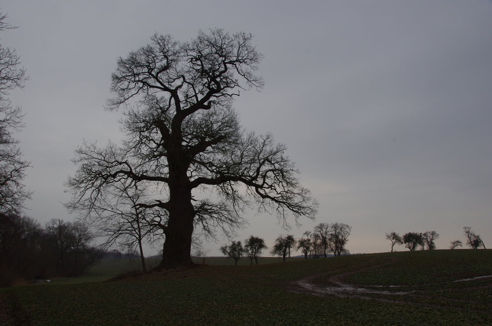
Das Gelände in dem sich die Eichen befinden ist umschlossen und es ist ein kleiner Unkostenbeitrag fällig. Die Eichen selber sind in einem etwas lädiertem Zustand. Das schaut natürlich im Winter immer besonders schlimm aus. Beeindruckend sind sie allemal und auf jeden Fall einen Besuch wert.
Zu dieser Jahreszeit war auf dem Gelände noch nichts los, so dass wir nach dem passieren der Huteschweine und des Cafés einen Ausgang nahmen und um den kleinen See herumgiengen. Dies ist auf jeden Fall auch sehr schön da wir noch einige schöne Baumriesen bewundern konnten.
Further information at
http://www.gemeinde-ivenack.de/Tour gallery


Tour map and elevation profile
Minimum height 38 m
Maximum height 57 m
More about the tour author
|
|
Pheinz |
Comments

Start und Ziel auf dem Parkplatz beim Schloss in Ivenack.
GPS tracks
Trackpoints-
GPX / Garmin Map Source (gpx) download
-
TCX / Garmin Training Center® (tcx) download
-
CRS / Garmin Training Center® (crs) download
-
Google Earth (kml) download
-
G7ToWin (g7t) download
-
TTQV (trk) download
-
Overlay (ovl) download
-
Fugawi (txt) download
-
Kompass (DAV) Track (tk) download
-
Track data sheet (pdf) download
-
Original file of the author (gpx) download
More about the tour author
|
|
Pheinz |
Add to my favorites
Remove from my favorites
Edit tags
Open track
My score
Rate