


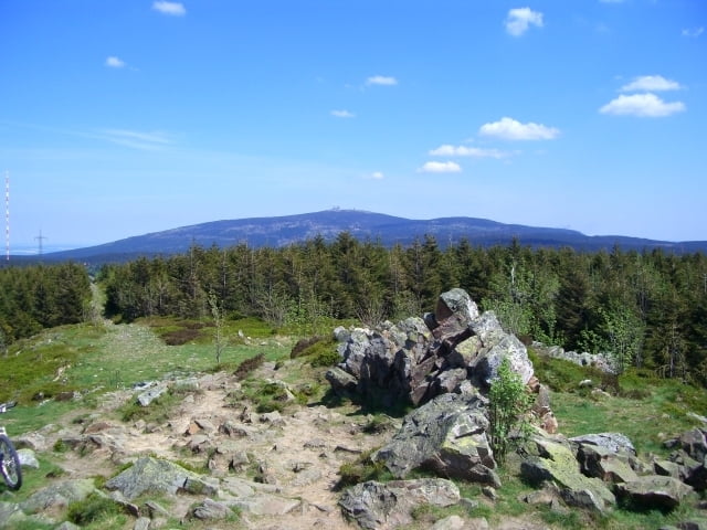
Einfach zu fahrende Harztour die in Osterode startet und über die 3 Berge (Schalke - Wolfswarte - Hanskühneburg) führt. Die Richtung - ob links oder rechts herum ist egal, es gibt ein kleines Schiebestück am Ockerstein - sonst ist die Strecke komplett fahrbar!! Ich wählte diesmal die Strecke Schalke – WW- HKB. Sie führt an den Clausthaler Seen vorbei - die im Sommer absolut badetauglich sind!! ... hat wohl was mit der Temperatur zu tun!! Man hat von jedem der 3 Berge eine wunderbare Aussicht und kann den Streckenverlauf schon mal verinnerlichen!!!
Wer will, kann die Tour auch um ca. 200Hm kürzen, wenn der Aufstieg zur Wolfswarte "umfahren" wird.
Wer will, kann die Tour auch um ca. 200Hm kürzen, wenn der Aufstieg zur Wolfswarte "umfahren" wird.
Further information at
http://www.harz.deTour gallery
Tour map and elevation profile
Minimum height 235 m
Maximum height 914 m
More about the tour author
|
|
Ridgeback |
Comments

Im Prinzip kann man an jeder Stelle der Tour einsteigen. Bei mir liegt der Startpunkt Osterode nahe, aufgrund der geringen Distanz zu Northeim! Diese Tour lässt sich auch mit den Touren aus Northeim kombinieren, dann kann man noch einmal ca. 40km und 500Hm dazu addieren – so das man dann eine schön zufahrende Tagestour mit 110km und über 2000 Hm fährt.
GPS tracks
Trackpoints-
GPX / Garmin Map Source (gpx) download
-
TCX / Garmin Training Center® (tcx) download
-
CRS / Garmin Training Center® (crs) download
-
Google Earth (kml) download
-
G7ToWin (g7t) download
-
TTQV (trk) download
-
Overlay (ovl) download
-
Fugawi (txt) download
-
Kompass (DAV) Track (tk) download
-
Track data sheet (pdf) download
-
Original file of the author (gpx) download
More about the tour author
|
|
Ridgeback |
Add to my favorites
Remove from my favorites
Edit tags
Open track
My score
Rate