


Start an der Kirche Arbogast ca. 2 km hinter Götzis. Von dort Richtung Sportplatz Fraxern auf guten, nicht zu steilen
Güterwegen. Vom Sportplatz geht es dann anfangs auf einem steilen Asphaltweg in Richtung Staffelalpe und Treietpass.
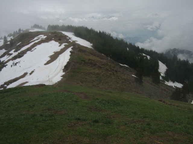
Von dort dann an der Kugelalpe vorbei bis kurz vor dem Gipfel. Die letzten Meter dann zu Fuß zum Gipfel.
Die nordseitigen Wege waren teilweise noch stark verschneit.
Zurück auf gleicher Strecke bis zur Abzeigung Richtung Wannenalpe (1.300 hm). Dies ist die offiziell ausgeschilderte MB Route Richtung Viktorsberg. In Viktorsberg auf der Haupstraße bis zur dritten Linkskehre. Von dort wieder auf der offiziellen MB-Route nach Klaus und von dort zum Ausgangspunkt.
Güterwegen. Vom Sportplatz geht es dann anfangs auf einem steilen Asphaltweg in Richtung Staffelalpe und Treietpass.
Von dort dann an der Kugelalpe vorbei bis kurz vor dem Gipfel. Die letzten Meter dann zu Fuß zum Gipfel.
Die nordseitigen Wege waren teilweise noch stark verschneit.
Zurück auf gleicher Strecke bis zur Abzeigung Richtung Wannenalpe (1.300 hm). Dies ist die offiziell ausgeschilderte MB Route Richtung Viktorsberg. In Viktorsberg auf der Haupstraße bis zur dritten Linkskehre. Von dort wieder auf der offiziellen MB-Route nach Klaus und von dort zum Ausgangspunkt.
Tour gallery
Tour map and elevation profile
Minimum height 455 m
Maximum height 1642 m
More about the tour author

|
Thomas1965 |
Comments

Auf der Rheintalautobahn bis zur Abfahrt Götzis. Dann durch Götzis Richtung Klaus. Parken an der Kirche St. Arbogast.
GPS tracks
Trackpoints-
GPX / Garmin Map Source (gpx) download
-
TCX / Garmin Training Center® (tcx) download
-
CRS / Garmin Training Center® (crs) download
-
Google Earth (kml) download
-
G7ToWin (g7t) download
-
TTQV (trk) download
-
Overlay (ovl) download
-
Fugawi (txt) download
-
Kompass (DAV) Track (tk) download
-
Track data sheet (pdf) download
-
Original file of the author (gpx) download
More about the tour author
|
|
Thomas1965 |
Add to my favorites
Remove from my favorites
Edit tags
Open track
My score
Rate