


Klassiker, einfache Tour durch weite Landschaften.
Vom Zipfelwirt zur Elandalm flache, erst zum Schluß mäßigsteile Auffahrt. Ausrollweg bis Valepp. Es lohnt der Abstecher.
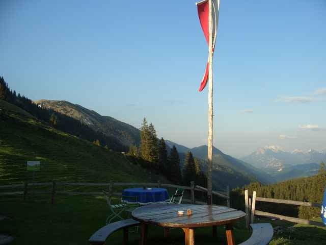
Richtung Erzherzog Johann Klause gibts einen schönen Höhenweg mit netten Eindrücken - siehe Bild.
Dann bergauf (Forstweg) zur Ackernalm mit tollem aber entferntem Blick auf Thiersee und Kaiser.
Auf Teer eine Vollgasstrecke auf Mautstrasse (Achtung blinde Autofahrer!) bis zum Ursprungspass.
Viele lohnende Einkehren: Forsthaus Valepp, Ackernalm
Vom Zipfelwirt zur Elandalm flache, erst zum Schluß mäßigsteile Auffahrt. Ausrollweg bis Valepp. Es lohnt der Abstecher.
Richtung Erzherzog Johann Klause gibts einen schönen Höhenweg mit netten Eindrücken - siehe Bild.
Dann bergauf (Forstweg) zur Ackernalm mit tollem aber entferntem Blick auf Thiersee und Kaiser.
Auf Teer eine Vollgasstrecke auf Mautstrasse (Achtung blinde Autofahrer!) bis zum Ursprungspass.
Viele lohnende Einkehren: Forsthaus Valepp, Ackernalm
Further information at
http://www.martin-blum.de/bikeTour gallery
Tour map and elevation profile
Minimum height 787 m
Maximum height 1350 m
More about the tour author
|
|
martin.blum |
Comments

A8 München- Salzburg, Ausfahrt Weyarn. Immer Richtung Bayrischzell und in Bayrischzell rechts ab nach Thiersee/ Kufstein.
Im Tal, noch vor dem Ursprungspass kommt rechts der Zipfelwirt mit Wanderparkplatz. Aber auch viele andere Ausgangsorte möglich!
GPS tracks
Trackpoints-
GPX / Garmin Map Source (gpx) download
-
TCX / Garmin Training Center® (tcx) download
-
CRS / Garmin Training Center® (crs) download
-
Google Earth (kml) download
-
G7ToWin (g7t) download
-
TTQV (trk) download
-
Overlay (ovl) download
-
Fugawi (txt) download
-
Kompass (DAV) Track (tk) download
-
Track data sheet (pdf) download
-
Original file of the author (gpx) download
More about the tour author
|
|
martin.blum |
Add to my favorites
Remove from my favorites
Edit tags
Open track
My score
Rate