Login

Forgot your login?

Cookies have to be accepted!
Your browser's cookie functionality is disabled. Please enable this functionality.

Not a member yet?

Register now
Login

Available for registred users only

Log in to use this feature.

Forgot your login?

Cookies have to be accepted!
Your browser's cookie functionality is disabled. Please enable this functionality.

Not a member yet?

Register now
Filter
Categories
Advanced filters
  • Distance (km)
  • Height
Save filters Reset filter

TrackRank

QRCode

Technical data

Distance33,3 km Height1202 m Way down1141 m Duration05:00 h:m Date27.10.2017
Scores Author Landscape Fun factor Fitness Technique

Statistics

416 Views Scores 97 Downloads Average
Rate
  • Track data sheet
  • Directions
  • Downloads

Endurotour S2-S3 über Passo San Giacomo zum Mt. Torre (S2-S3) bis Imperia auf Höhenzug

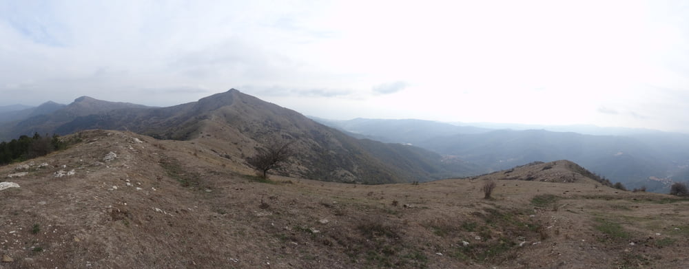
mein Jahreshighlight für 2017. Hatte eigentlich zum Mt. Ceresa gewollt und gps track vergessen. Unverhofft ein schöner Trail, und der Mt. Torre war aus der Ferne ein Wow.

bis kurz vor San Giacomo auf Fahrwegen, Schiebeanteil mit ebike 100hm, ohne 200hm.

Relativ ruppige Trails, scheinbar endlos.


Tour gallery

Tour map and elevation profile

  • Open Street Map
  • Google
Minimum height 10 m Maximum height 991 m Detailed view

More about the tour author

skyhopper
Member since 2005

Send private message

Comments

parken in imperia

GPS tracks

Trackpoints
  • GPX / Garmin Map Source (gpx) download
  • TCX / Garmin Training Center® (tcx) download
  • CRS / Garmin Training Center® (crs) download
  • Google Earth (kml) download
  • G7ToWin (g7t) download
  • TTQV (trk) download
  • Overlay (ovl) download
  • Fugawi (txt) download
  • Kompass (DAV) Track (tk) download
  • Track data sheet (pdf) download
  • Original file of the author (gpx) download

More about the tour author

skyhopper
Member since 2005

Send private message
Share track
Add to my favorites
Remove from my favorites
Edit tags
My score
Rate
Track: Imperia - Passo San Giacomo - Mt. Torre Enduro ruppig
Type: Mountain bike
Distance: 33,3 km
Evaluated on:
Duration:
Day(s)
Hour(s)
Minute(s)
Score: Landscape Fun factor Fitness Technique