


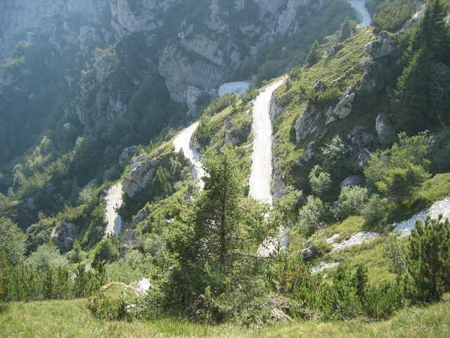
Von Vesio auf Teer Richtung Molkerei Alp del Garda. Dort rechts auf die Schotterstraße in Val Michele. Hinter der kleinen Staumauer rechts auf Schotter weiter und dann die nächste Linkskehre immer aufwärts bis zum Wegdreieck auf 1325 m. Hier rechts Richtung Rifugio Garda. Auf dem Weg kommt man am Malga Ciapa vorbei.
Hier viel leckere Einkehr als im überfüllten Rifugio Garda! Hier kommen keine Shuttle-Biker vorbei :)
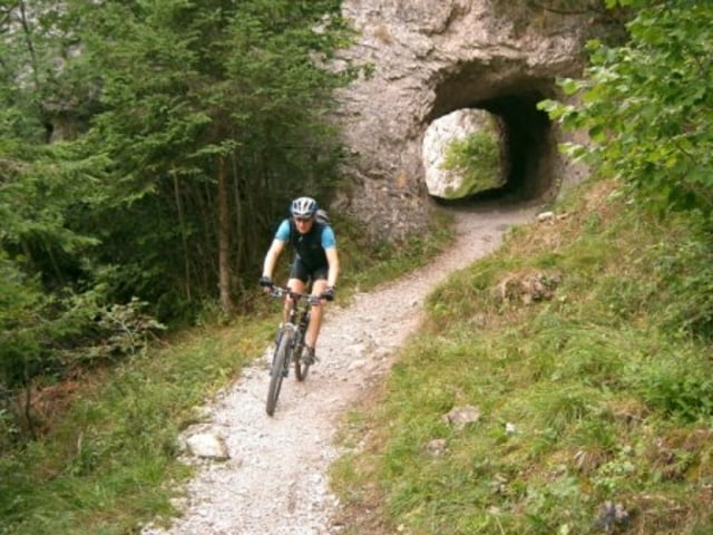
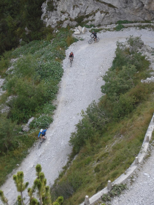
Von hier gehts dann weiter zum Rifugio und dort auf den weiteren Uphill zum Tremalzo-Tunnel. Oben angekommen gehts ca. 8 km Downhill bis zum Passo Nota. Dort Uphill Richtung Cimitero (kleiner Soldatenfriedhof)und durch sieben kleine Tunnel über den Corna Vecchia Downhill zurück zum Parkplatz in Vesio!
Hier viel leckere Einkehr als im überfüllten Rifugio Garda! Hier kommen keine Shuttle-Biker vorbei :)
Von hier gehts dann weiter zum Rifugio und dort auf den weiteren Uphill zum Tremalzo-Tunnel. Oben angekommen gehts ca. 8 km Downhill bis zum Passo Nota. Dort Uphill Richtung Cimitero (kleiner Soldatenfriedhof)und durch sieben kleine Tunnel über den Corna Vecchia Downhill zurück zum Parkplatz in Vesio!
Further information at
http://www.hegibiketours.deTour gallery
Tour map and elevation profile
Minimum height 567 m
Maximum height 1837 m
More about the tour author
|
|
hegi |
Comments
Von Limone nach Vesio rauf und dort auf dem Parkplatz wo der Hubschrauberlandeplatz ist!
GPS tracks
Trackpoints-
GPX / Garmin Map Source (gpx) download
-
TCX / Garmin Training Center® (tcx) download
-
CRS / Garmin Training Center® (crs) download
-
Google Earth (kml) download
-
G7ToWin (g7t) download
-
TTQV (trk) download
-
Overlay (ovl) download
-
Fugawi (txt) download
-
Kompass (DAV) Track (tk) download
-
Track data sheet (pdf) download
-
Original file of the author (gpx) download
More about the tour author
|
|
hegi |
Add to my favorites
Remove from my favorites
Edit tags
Open track
My score
Rate
Rifugio Gardia