


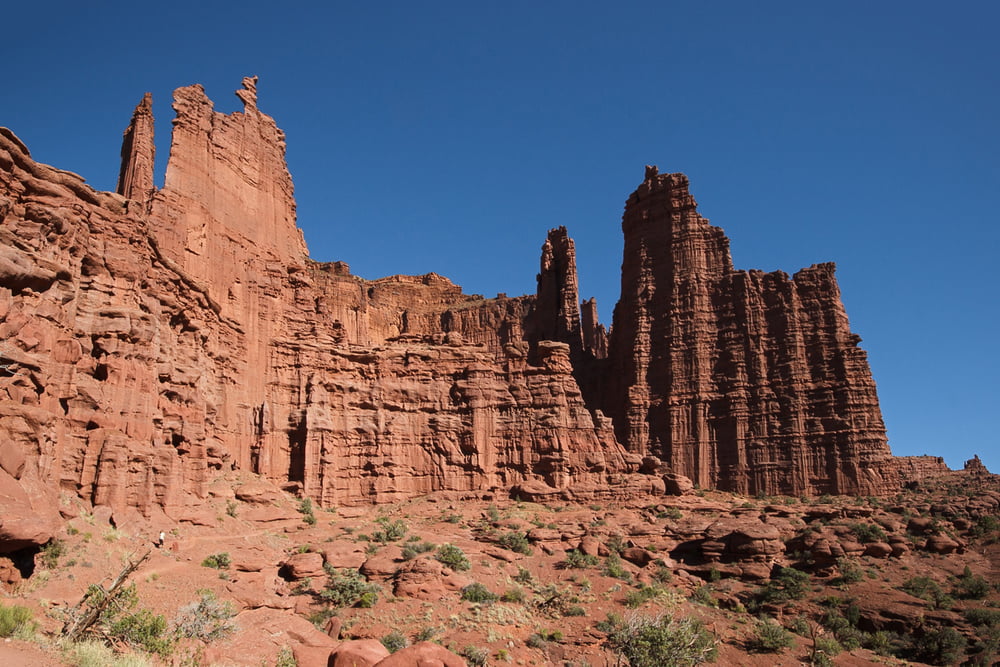
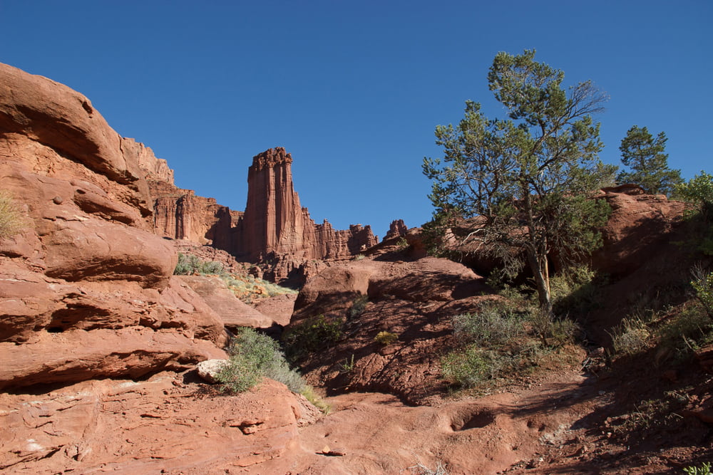
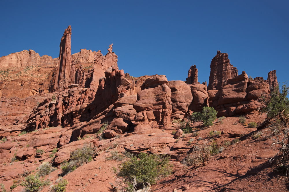
Diese spektakuläre Wanderung nicht weit von Moab / Utah führt vorbei an den faszinierenden "Fisher Towers", großen roten Felssäulen mit charakteristischer Streifung. Die Wanderung ist moderat, führt mal runter mal rauf, und weitgehend an den Türmen entlang. Es ergeben sich ständig neue Blickwinkel und es dauert etwas, bis man die "Architektur" dieser einmaligen Landschaft erfasst hat.
Wenn man das ganze von oben sehen will, ist der Top Of The World Trail zu empfehlen (Tour #162316).
Machen Sie diese Wanderung am besten am Nachmittag bis Abend. Bei Sonnenuntergang werden Sie die Fisher Towers in einem fast unwirklichen und strahlenden Rot sehen.
Man kommt vorbei an den bekannten Formationen King Fisher, Ancient Art (hier sind oft auch Kletterer unterwegs), Cottontail Tower und Titan. Wir sind nach Blick auf den Titan umgekehrt, man kann aber noch ein Stück weiterlaufen bis unter den Titan.
Tour gallery

Tour map and elevation profile
Minimum height 1414 m
Maximum height 1539 m
More about the tour author
|
|
Carlos19 |
Comments

Sie fahren von Moab aus auf die Utah 128 am Colorado entlang. Nach 32,5 km biegt eine Schotterpiste nach rechts ab, dieser folgen Sie 3,2 km bis zum Parkplatz des Fisher Tower Campground. Hier sehen Sie schon den King Fisher und hier beginnt der Trail.
GPS tracks
Trackpoints-
GPX / Garmin Map Source (gpx) download
-
TCX / Garmin Training Center® (tcx) download
-
CRS / Garmin Training Center® (crs) download
-
Google Earth (kml) download
-
G7ToWin (g7t) download
-
TTQV (trk) download
-
Overlay (ovl) download
-
Fugawi (txt) download
-
Kompass (DAV) Track (tk) download
-
Track data sheet (pdf) download
-
Original file of the author (gpx) download
More about the tour author
|
|
Carlos19 |
Add to my favorites
Remove from my favorites
Edit tags
Open track
My score
Rate