


- Rundkurs im Uhrzeigersinn.
- Start/Ziel: Albeins bei Brixen.
- Von Albeins (MH 603) angenehm ansteigend, auf Schotter, unterbrochen durch asfaltierte Abschnitte, durch das schmale, schattige Aferer Tal, am gleichnamigen Bach entlang bergauf bis zum höchsten Punkt der Tour (KM13,2-MH1.660). Eine steile ca. 200 MT. lange Betonrampe.
- Weiter auf Schotter in stetigem Auf und Ab bis (KM17,4-MH1.560).
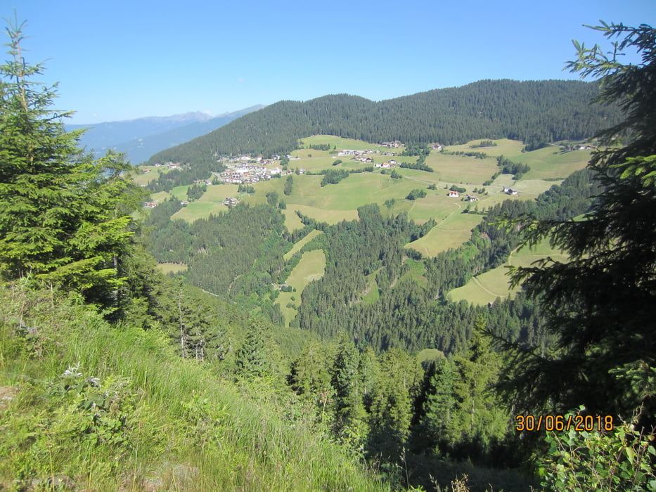
- Etwas später erfolgt der Wechsel auf die Vilnösser Talseite. Der Blick ins Villnösser-Tal und auf die Geislergruppe ist das Sahnehäubchen der Tour.
- Abfahrt nach St.Peter (KM21,3-MH1.140). Von St.Peter mittelsteiler Aufstieg bis zur Jausenstation "Moarhof" (KM25,3-MH1.350).
- Ab (KM25,8-MH-1.350) Abfahrt auf Karrenweg, flowigem Steig, Schotter, bzw. Asfalt hinunter ins Tal zurück zum Ausgangspunkt nach Albeins (Km34,5-MH603). Herrlicher Ausblick auf das Eisacktal und den Brixner Talkessel.
- PS. Brunnen KM 13,1 + 30,7.
Tour gallery


Tour map and elevation profile
Minimum height 602 m
Maximum height 1665 m
More about the tour author
|
|
MargesinFriedrich |
Comments

GPS tracks
Trackpoints-
GPX / Garmin Map Source (gpx) download
-
TCX / Garmin Training Center® (tcx) download
-
CRS / Garmin Training Center® (crs) download
-
Google Earth (kml) download
-
G7ToWin (g7t) download
-
TTQV (trk) download
-
Overlay (ovl) download
-
Fugawi (txt) download
-
Kompass (DAV) Track (tk) download
-
Track data sheet (pdf) download
-
Original file of the author (gpx) download
More about the tour author
|
|
MargesinFriedrich |
Add to my favorites
Remove from my favorites
Edit tags
Open track
My score
Rate