


Costermano - Murlongo - Gazzoli - Primo Maggio - Coletto - Bezzo - Cristane - Zuane di Sopra - Zuane Osteria - Bicci Grill - Forte San Marco - San Martino-Platano - Caprino Veronese - Boi - Pesina Spezie - Pesina - Costermano
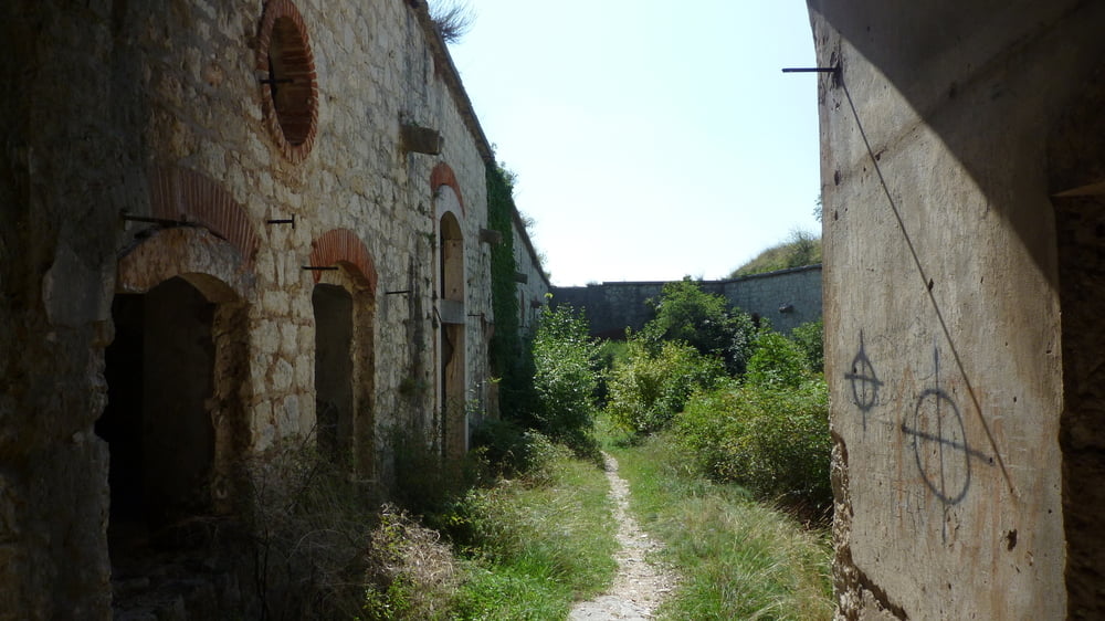
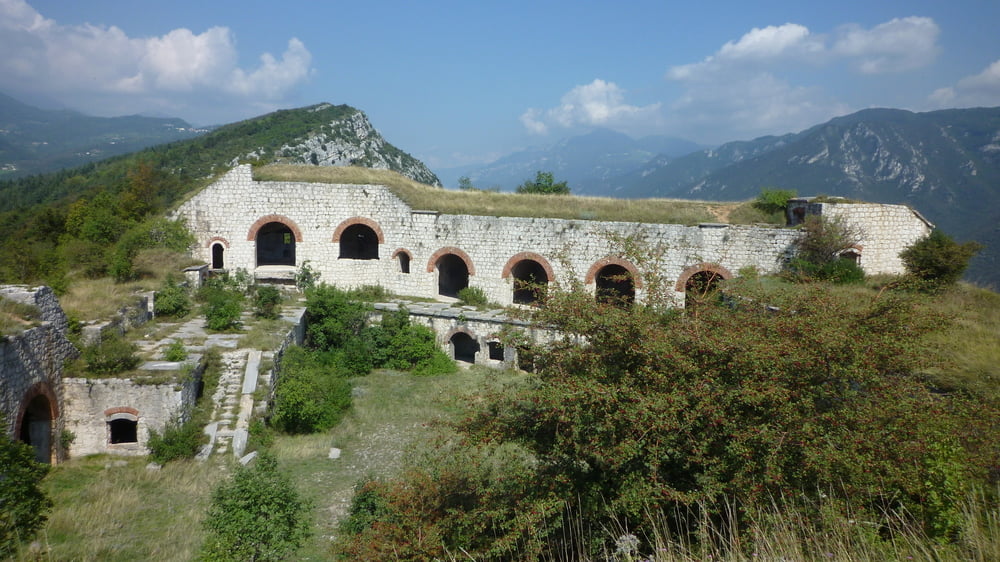
Die Auffahrt zum Forte San Marco startet am neuen Bicci Grill und führt auf rund 2,64 km und 240 hm über viele Serpentinen zum Platz vor dem Fort. Das Fort ist der Öffentlichkeit zugänglich und kann besichtigt werden.
Die Auffahrt erfolgt zumeist auf sehr losem und großem Geröll. Zudem sind immer wider Abschnitte mit große Felsplatten und Felsstufen zu bewältigen. Auf openMTBmaps wird sie mit Singetrail Skala 1 für das Hinauffahren und Singetrail Skala 2 für das Hinabfahren kategorisiert.
Die von uns gewählte Abfahrt auf der Rückseite des Forte San Marco ist laut openMTBmaps mit Singetrail Skala 2, falls man diesen Weg für die Auffahrt wählt, und mit Singetrail Skala 4 für das Hinabfahren bewertet. Hier geht der Weg nahezu gerade und ohne Serpentinen hinunter und erfordert einges and Fahrtechnikund ist somit nichts für ungeübte.
Das Forte San Marco wird wohl immer wieder für Softair-Schlachten genutzt, denn der Boden ist übersäht mit den kleinen Kunststoffkugeln.
Tour gallery


Tour map and elevation profile
Minimum height 184 m
Maximum height 442 m
More about the tour author

|
Comments

Von München über die A9 zum Inntaldreieck. Weiter über die Inntalautobahn A12 nach Innsbruck und von dort über die Brenner Autobahn A13 nach Italien. Vom Brenner über die Autostarda A22 über Bolzano und Trento bis zur Autobahnausfahrt in Affi. Startpunkt der Tour ist in Costermano oberhalb von Garda.
GPS tracks
Trackpoints-
GPX / Garmin Map Source (gpx) download
-
TCX / Garmin Training Center® (tcx) download
-
CRS / Garmin Training Center® (crs) download
-
Google Earth (kml) download
-
G7ToWin (g7t) download
-
TTQV (trk) download
-
Overlay (ovl) download
-
Fugawi (txt) download
-
Kompass (DAV) Track (tk) download
-
Track data sheet (pdf) download
-
Original file of the author (tcx) download
More about the tour author
|
|
Add to my favorites
Remove from my favorites
Edit tags
Open track
My score
Rate