


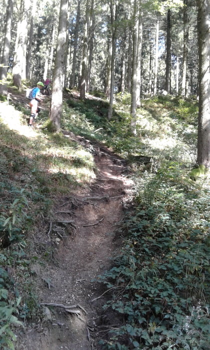
vom Wanderparkplatz bei Buchenstock/Großholzleute/Isny auf Kiesweg hoch und nach ca. 300 hm auf Trail wieder runter (S1-S2). Dann gleichen Weg wieder hoch zum Turm Schwarzer Grat und auf Singletrail (S1-S2) wieder runter bis zu einem Bildstock. Wieder auf Kiesweg hoch. In der Wenger Alpe Egg Brotzeit gemacht und wieder zurück zum Hochgrat Turm. Dann auf spannendem Singletrail wieder runter zum Auto (S1-S2).
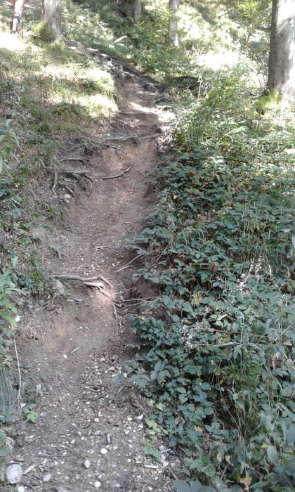
Die Trails sind teilweise sehr mit Wurzeln durchsetzt und stellenweise sehr steil. Es ist empfehlens-wert die Tour bei halbwegs trockenem Untergrund zu fahren, sonst glitschig und schmierig (Wurzeln, Lehm, lose Steine)
Tour gallery


Tour map and elevation profile
Minimum height 785 m
Maximum height 1121 m
More about the tour author
|
|
Fruehaufsteher |
Comments
GPS tracks
Trackpoints-
GPX / Garmin Map Source (gpx) download
-
TCX / Garmin Training Center® (tcx) download
-
CRS / Garmin Training Center® (crs) download
-
Google Earth (kml) download
-
G7ToWin (g7t) download
-
TTQV (trk) download
-
Overlay (ovl) download
-
Fugawi (txt) download
-
Kompass (DAV) Track (tk) download
-
Track data sheet (pdf) download
-
Original file of the author (gpx) download
More about the tour author
|
|
Fruehaufsteher |
Add to my favorites
Remove from my favorites
Edit tags
Open track
My score
Rate
?
Die ideale Trail-Tour für den Beginn/Ende der Saison oder nach Feierabend