


Wer sich ein wenig einfahren möchte, parkt schon am Parkplatz vor der Mautstation. 3 USD kostet es pro Person (day-use), Camping 13 USD.
Über die Dammstraße geht es dann zur Insel. Es stinkt an manchen Tagen ein wenig…
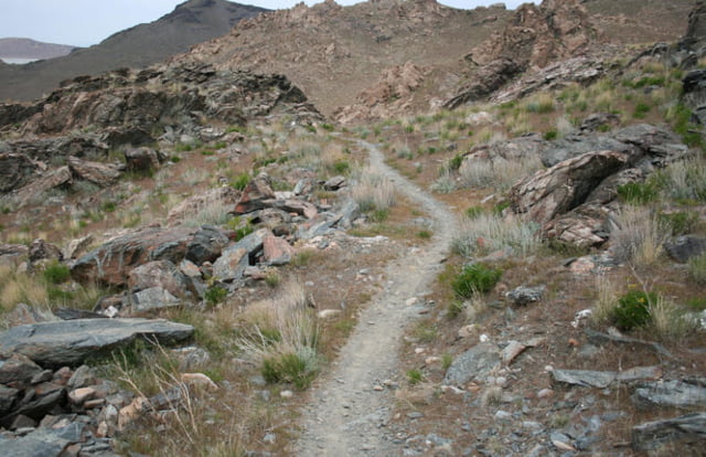
Auf der Insel erst einmal Teerstraße bis zum Camp und dann schöner Trail, meist fahrbar, aber auch holprige Stücke.
Elephant-Head lohnt sich (Stichweg), auf jeden Fall dann ins Tal hinab fahren und den schönen Trail wieder hoch (Split Rock Bay Loop).
Der 2. Loop ist nicht so spektakulär, alles Schotterstraße, die Abfahrt hinab zur Bucht ist nochmal schön.
Further information at
http://www.utahmountainbiking.com/trails/Tour gallery

Tour map and elevation profile
Minimum height 1285 m
Maximum height 1505 m
More about the tour author
|
|
RandB |
Comments

Von SLC nac h Norden auf der I15, bis die Ausfahrt "Antelope Island" kommt.
GPS tracks
Trackpoints-
GPX / Garmin Map Source (gpx) download
-
TCX / Garmin Training Center® (tcx) download
-
CRS / Garmin Training Center® (crs) download
-
Google Earth (kml) download
-
G7ToWin (g7t) download
-
TTQV (trk) download
-
Overlay (ovl) download
-
Fugawi (txt) download
-
Kompass (DAV) Track (tk) download
-
Track data sheet (pdf) download
-
Original file of the author (gpx) download
More about the tour author
|
|
RandB |
Add to my favorites
Remove from my favorites
Edit tags
Open track
My score
Rate