


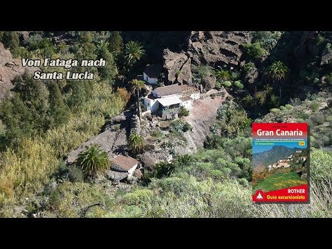
Die Wanderung startet am Ortsrand von Fataga. Zunächst gehen wir auf der Asphaltstraße Bergan, bis uns der erste Wegweiser in die Berge schickt. Den Bergkamm erreicht blicken wir in den Barranco de Tirajana und sehen bereits unser Ziel, Santa Lucia, vor uns. Über einen Serpentinenpfad gehen wir in den Grund des Barranco hinunter und nach Santa Lucia hinauf. Nach einer Ortsbesichtigung geht es wieder zurück zum Ausgangspunkt.
Tour gallery


Tour map and elevation profile
Minimum height 99999 m
Maximum height -99999 m
More about the tour author
|
|
schleidy |
Comments

GPS tracks
Trackpoints-
GPX / Garmin Map Source (gpx) download
-
TCX / Garmin Training Center® (tcx) download
-
CRS / Garmin Training Center® (crs) download
-
Google Earth (kml) download
-
G7ToWin (g7t) download
-
TTQV (trk) download
-
Overlay (ovl) download
-
Fugawi (txt) download
-
Kompass (DAV) Track (tk) download
-
Track data sheet (pdf) download
-
Original file of the author (gpx) download
More about the tour author
|
|
schleidy |
Add to my favorites
Remove from my favorites
Edit tags
Open track
My score
Rate