


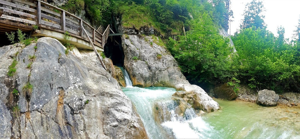
Klein aber fein, so könnte man diese Wanderung mit wenigen Worten beschreiben.
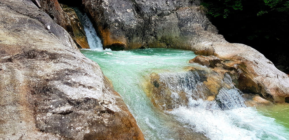
Wir wandern vom Parkplatz der Saalach flußabwärts entlang bis man rechter Hand dann nach wenigen Gehminuten die wildromantische Innersbachklamm erblickt. Die Klamm ist frei zugänglich nicht allzu lang und ist auch mit Kindern gut machbar.
Auf der Runde befindet sich auch ein Gasthaus (DreiBrüder)
Further information at
https://www.loferurlaub.at/natur-und-kultur-in-lofer/gps-touren-lofer/Tour gallery

Tour map and elevation profile
Minimum height 549 m
Maximum height 577 m
More about the tour author
|
|
GarminSalzburg |
Comments

Wenn Sie auf der B178 von Lofer Richtung Unken fahren dann treffen Sie auf das Hinweisschild Reith. Dort biegen Sie rechts hinein , fahren über die Brücke und finden gleich nach der Brücke Parkplätze vor.
GPS tracks
Trackpoints-
GPX / Garmin Map Source (gpx) download
-
TCX / Garmin Training Center® (tcx) download
-
CRS / Garmin Training Center® (crs) download
-
Google Earth (kml) download
-
G7ToWin (g7t) download
-
TTQV (trk) download
-
Overlay (ovl) download
-
Fugawi (txt) download
-
Kompass (DAV) Track (tk) download
-
Track data sheet (pdf) download
-
Original file of the author (gpx) download
More about the tour author
|
|
GarminSalzburg |
Add to my favorites
Remove from my favorites
Edit tags
Open track
My score
Rate