


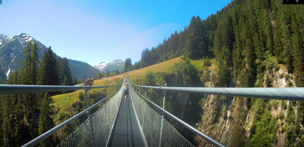
Kleine Wanderung auf guten Wegen (T1-T2) in toller Landschaft. Höhepunkt ist die Sicht auf den Simms Wasserfall mit Klettersteig, Höhenbach Wasserfall und auf dem Rückweg geht’s über die Holzgauer Hängebrücke.
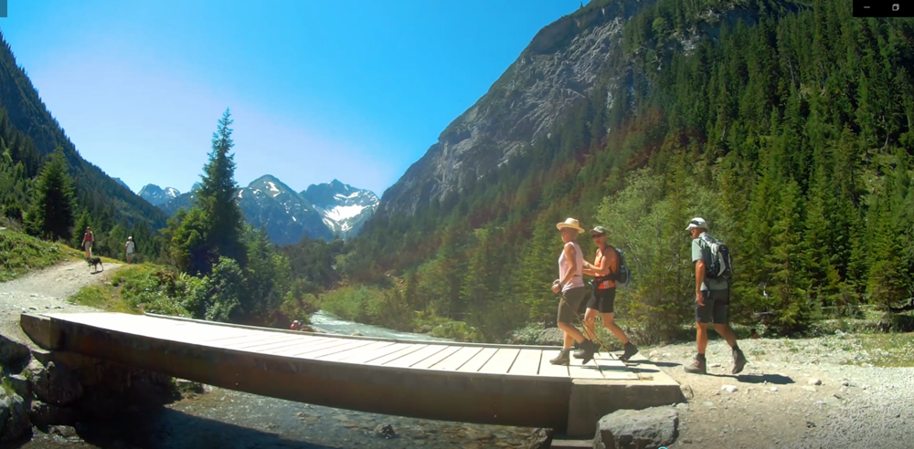
Wir starten in Holzgau beim Gashaus Bären entlang am Höhenbach. Vorbei am Kraftwerk und laufen unter der Hängebrücke hindurch. Leicht ansteigend geht es hoch zum Simms Wasserfall und vorbei beim Cafe Uta bis zur Roßgumpenalm. Dort rasten wir.
Anschließend machen wir einen kurzen Abstecher links 100 Meter zum Höhenbach Wasserfall. Auf gleichem Weg geht es hinunter bis zum Cafe Uta (links weiter auf Pfad).
Kommen über die Holzgauer Hängebrücke wieder zum Ausgangspunkt.
Further information at
https://www.lechtal-info.com/touren/haengebruecke-holzgau.htmlTour gallery


Tour map and elevation profile
Minimum height 1110 m
Maximum height 1350 m
More about the tour author
|
|
W-C |
Comments

Anfahrt mit dem Auto
Anfahrt von Norden:
Stuttgart - Ulm - Kempten - Reutte/Tirol - Lechtal
Anfahrt von Süden:
Brenner/Reschenpaß - Fernpaß - Reutte/Tirol - Lechtal
Anfahrt von Westen:
Zürich - Bregenz - Bregenzerwald - Warth oder Klostertal, Zürs, Lech, Warth (Achtung Wintersperre!) - Lechtal
Anfahrt von Osten:
Salzburg - Innsbruck - Fernpaß - Reutte/Tirol - Lechtal

ACHTUNG !!!
Lech/Warth ist im Winter gesperrt.
Holzgau ist ohne Vignette erreichbar
Parkplatz Koordinaten:
N47° 15.643'
E10° 20.604'
GPS tracks
Trackpoints-
GPX / Garmin Map Source (gpx) download
-
TCX / Garmin Training Center® (tcx) download
-
CRS / Garmin Training Center® (crs) download
-
Google Earth (kml) download
-
G7ToWin (g7t) download
-
TTQV (trk) download
-
Overlay (ovl) download
-
Fugawi (txt) download
-
Kompass (DAV) Track (tk) download
-
Track data sheet (pdf) download
-
Original file of the author (gpx) download
More about the tour author
|
|
W-C |
Add to my favorites
Remove from my favorites
Edit tags
Open track
My score
Rate