
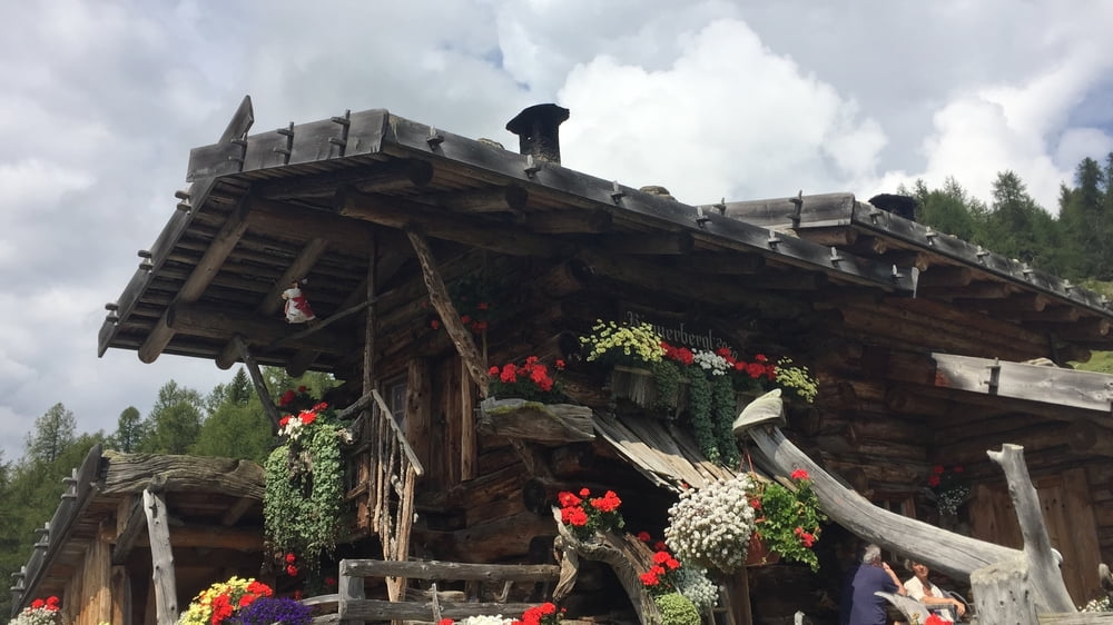

Landesstraße ins Ultental, Abzweigung nach Laurein, dort nach 100 m rechts Parkplatz. Da starten wir unsere Tour, fahren den Radweg weiter und den Staudamm hoch, queren denselben und nehmen die schöne Forststraße an der Ostseite des Stausees. Am Ende des Sees angelangt biegen wir rechts ab und fahren die Landesstraße (auf dem Fußweg) zurück bis zur Abzweigung (links) Schwemmalm. Wir nehmen die Straße zur Schwemmalm und biegen bald rechts ab gegen Riem. Zuerst Asphalt, dann die letzten 3 km Forststraße bis zur Riemerbergl Alm 2060m , technisch nicht schwierig, aber mit einigen Rampen. Die Alm ist im Sommer bewirtschaftet, ohne Strom. Wir nehmen denselben Rückweg bis zu Abzweigung St. Walburg und fahren dann direkt nach St. Walburg hinunter und wetterbedingt weiter auf der Landesstraße bis zum Startpunkt.
Tour map and elevation profile
Minimum height 808 m
Maximum height 2054 m
More about the tour author

|
Bluetooth |
Comments

GPS tracks
Trackpoints-
GPX / Garmin Map Source (gpx) download
-
TCX / Garmin Training Center® (tcx) download
-
CRS / Garmin Training Center® (crs) download
-
Google Earth (kml) download
-
G7ToWin (g7t) download
-
TTQV (trk) download
-
Overlay (ovl) download
-
Fugawi (txt) download
-
Kompass (DAV) Track (tk) download
-
Track data sheet (pdf) download
-
Original file of the author (gpx) download
More about the tour author
|
|
Bluetooth |
Add to my favorites
Remove from my favorites
Edit tags
Open track
My score
Rate