
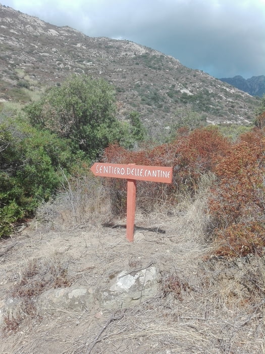

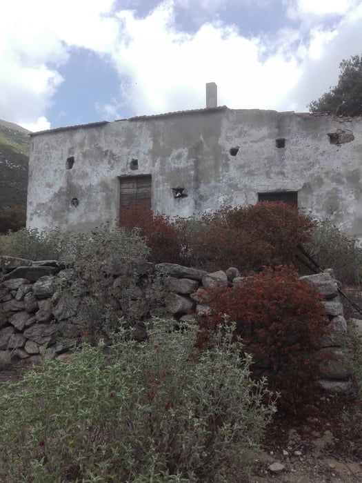
Si parte dal ponticello di pomonte e si risale per breve tratto la GTE. Trovata l'indicazione sentiero delle cantine si risale lentamente la valle con tratti a volte poco agevoli a causa della vegetazione infestante. Successivamente il percorso diviene moto più agevole e ben tracciato con segni blu e qualche ometto di pietra.Prestare attenzione alla vostra sinistra per le sette brevi deviazioni per visitare i resti delle antiche cantine di Pomonte. Il percorso segue una traccia accompagnata da un paio di tubi di plastica per l'acqua fino la lasciarli in prossimità di un attraversamento comunque ben segnalato. Il percorso di rientro avviene seguendo il sentiero numero nove per Pomonte.
Further information at
http://www.islepark.it/Tour gallery

Tour map and elevation profile
Minimum height 31 m
Maximum height 360 m
More about the tour author

|
mikyross |
Comments

italia toscana livorno isola d'elba marcina pomonte via del passatoio 101
GPS tracks
Trackpoints-
GPX / Garmin Map Source (gpx) download
-
TCX / Garmin Training Center® (tcx) download
-
CRS / Garmin Training Center® (crs) download
-
Google Earth (kml) download
-
G7ToWin (g7t) download
-
TTQV (trk) download
-
Overlay (ovl) download
-
Fugawi (txt) download
-
Kompass (DAV) Track (tk) download
-
Track data sheet (pdf) download
-
Original file of the author (gpx) download
More about the tour author
|
|
mikyross |
Add to my favorites
Remove from my favorites
Edit tags
Open track
My score
Rate