

Wir haben die Tour mit dem E MTB gemacht, da macht es bei den Uphills und den extremen Steigungen einfach mehr Spaß! Uphillflow! Ein Fully ist auf der Strecke sicher von großem Vorteil.
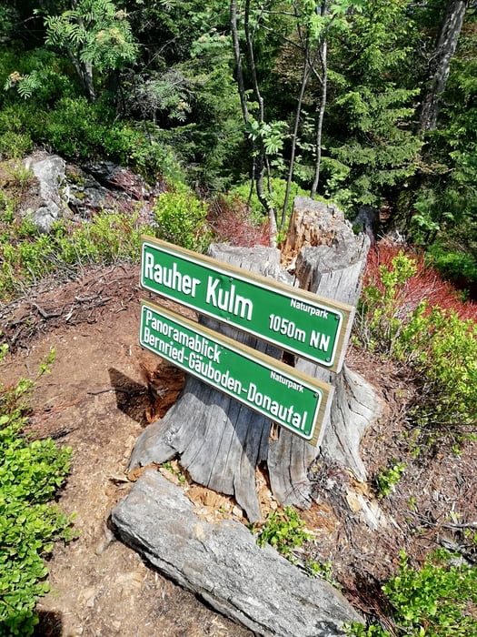
Downhill: die schönsten Trails in der Gegend teilweise technisch recht anspruchvoll, bei der Abfaht vom Hirschenstein ist auf diesem Trail sehr gute Bikebeherrschung Vorrausetzung! Alternativ die einfachere Abfahrt direkt zum Mühlgrabenweg, das ist ein sehr schöner flowiger Trail.
Über einen Kommentar und Bewertung würde ich mich freuen.
Tour gallery
Tour map and elevation profile
Minimum height 333 m
Maximum height 1065 m
More about the tour author
|
|
GILBERTMU |
Comments

GPS tracks
Trackpoints-
GPX / Garmin Map Source (gpx) download
-
TCX / Garmin Training Center® (tcx) download
-
CRS / Garmin Training Center® (crs) download
-
Google Earth (kml) download
-
G7ToWin (g7t) download
-
TTQV (trk) download
-
Overlay (ovl) download
-
Fugawi (txt) download
-
Kompass (DAV) Track (tk) download
-
Track data sheet (pdf) download
-
Original file of the author (gpx) download
More about the tour author
|
|
GILBERTMU |
Add to my favorites
Remove from my favorites
Edit tags
Open track
My score
Rate