


Einfache Tour mit Abstecher ins hintere Neckertal bis Ampferenboden:
Zunächst geht es durch das Neckartal Richtung SO bis Furth, dort beginnt der Aufsteig übereine kleine Teerstraße nach Hemberg, von dort weitere Richtung Krummenau, ehe es beim Guggeloch links in ein kleines Seitental hinauf geht.
Es folgt eine Abfahrt über eine Wiese nach Mistelegg ins hintere Neckertal. Von dort kann man noch einen Abstecher taleinwärts bis Ampferenboden machen. Zürück geht es wieder durch das Neckertal durch Richtung Brunnadern.
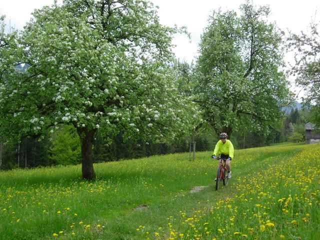
Tour gallery
Tour map and elevation profile
Minimum height 630 m
Maximum height 1109 m
More about the tour author

|
schmirk |
Comments

Startpunkt Brunnadern (Bahnhof);
von St.Gallen über Herisau Richtung Wattwil; vor dem Anstieg nach Wasserfluh rechts nach Brunnadern; Parken am Bahnhof möglich.
von St.Gallen über Herisau Richtung Wattwil; vor dem Anstieg nach Wasserfluh rechts nach Brunnadern; Parken am Bahnhof möglich.
GPS tracks
Trackpoints-
GPX / Garmin Map Source (gpx) download
-
TCX / Garmin Training Center® (tcx) download
-
CRS / Garmin Training Center® (crs) download
-
Google Earth (kml) download
-
G7ToWin (g7t) download
-
TTQV (trk) download
-
Overlay (ovl) download
-
Fugawi (txt) download
-
Kompass (DAV) Track (tk) download
-
Track data sheet (pdf) download
-
Original file of the author (g7t) download
More about the tour author
|
|
schmirk |
Add to my favorites
Remove from my favorites
Edit tags
Open track
My score
Rate