

Aufstieg von Zögernitz über den Treibsteig
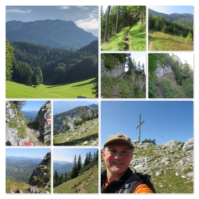
Startpunkt der Wanderung ist der Mostheurige Wieser, Weißenbach 77 in Zögernitz. Zuerst folgt man der sehr guten rot/weiß Markierung auf der Forststraße. Bald zweigt der Wanderweg linkerhand ab. Der Wanderweg führt auf den Ursprungkogel (959m) und dann weiter bis zum Gippeltörl.
Rechterhand steigt der Pfad an und führt bis zum Gippel Gipfelkreuz (1669m). Immer wieder sieht man die Gippelhütte, die jedoch schon geschlossen hat (Öffnungszeiten sind an die Fiehwirtschaft gebunden).
Nach einer kurzen Rast beim Gipfelkreuz mit seiner wunderbaren Fernsicht, geht es den gleichen Weg zurück zum Gippeltörl.
Further information at
https://de.wikipedia.org/wiki/GippelTour map and elevation profile
Minimum height 689 m
Maximum height 1663 m
Comments

Parkplatz an den Koordinaten: N47° 49' 32.8" E15° 35' 51.1"1
Adresse: Zögernitz, Weißenbach 77
Mosheuriger Wieser
Start der Wanderung: N47° 49' 33.0" E15° 35' 51.1"
GPS tracks
Trackpoints-
GPX / Garmin Map Source (gpx) download
-
TCX / Garmin Training Center® (tcx) download
-
CRS / Garmin Training Center® (crs) download
-
Google Earth (kml) download
-
G7ToWin (g7t) download
-
TTQV (trk) download
-
Overlay (ovl) download
-
Fugawi (txt) download
-
Kompass (DAV) Track (tk) download
-
Track data sheet (pdf) download
-
Original file of the author (gpx) download
Add to my favorites
Remove from my favorites
Edit tags
Open track
My score
Rate