Login

Forgot your login?

Cookies have to be accepted!
Your browser's cookie functionality is disabled. Please enable this functionality.

Not a member yet?

Register now
Login

Available for registred users only

Log in to use this feature.

Forgot your login?

Cookies have to be accepted!
Your browser's cookie functionality is disabled. Please enable this functionality.

Not a member yet?

Register now
Filter
Categories
Advanced filters
  • Distance (km)
  • Height
Save filters Reset filter

TrackRank

QRCode

Technical data

Distance16,1 km Height160 m Way down151 m Duration02:06 h:m Date24.07.2019
Scores Author Landscape Fun factor Fitness Technique

Statistics

140 Views Scores 3 Downloads Average
Rate
  • Track data sheet
  • Directions
  • Downloads
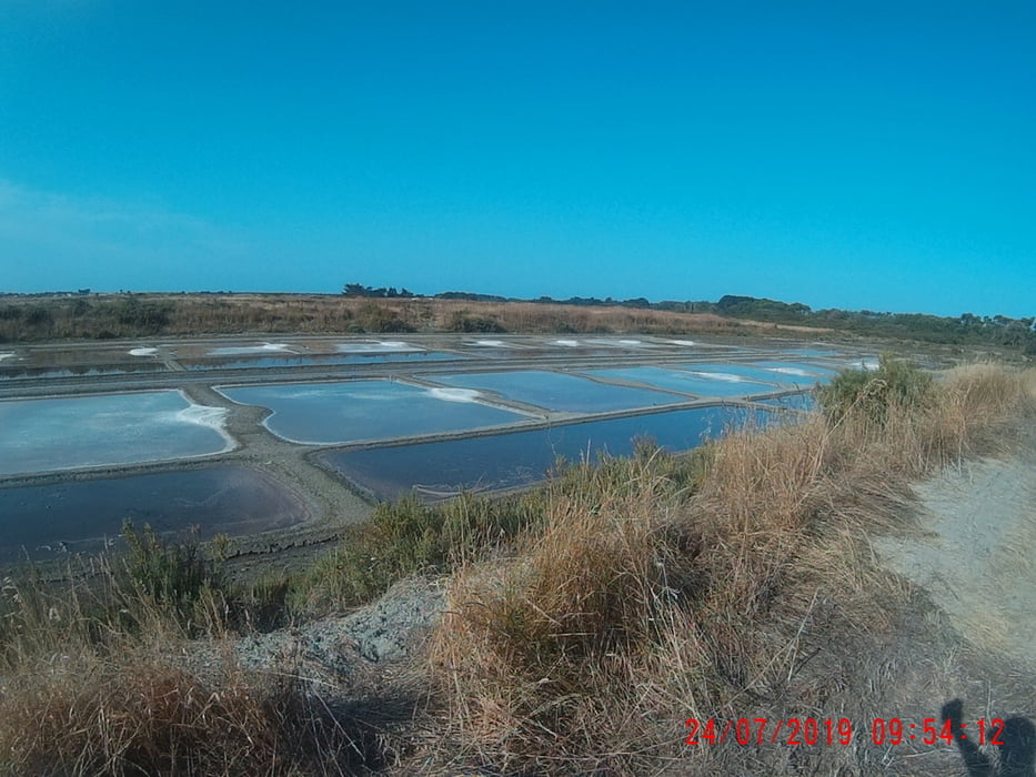
Quer über die Insel! Ohne etrex(Garmin-Navi) findet man als frmder niemehr aus den Salinen heraus! ;-)

Tour gallery

Tour map and elevation profile

  • Open Street Map
  • Google
Minimum height -22 m Maximum height 22 m Detailed view

More about the tour author

Perikles
Member since 2018

Send private message

Comments

Paris => Nant =>Île de Noirmoutier

GPS tracks

Trackpoints
  • GPX / Garmin Map Source (gpx) download
  • TCX / Garmin Training Center® (tcx) download
  • CRS / Garmin Training Center® (crs) download
  • Google Earth (kml) download
  • G7ToWin (g7t) download
  • TTQV (trk) download
  • Overlay (ovl) download
  • Fugawi (txt) download
  • Kompass (DAV) Track (tk) download
  • Track data sheet (pdf) download
  • Original file of the author (gpx) download

More about the tour author

Perikles
Member since 2018

Send private message
Share track
Add to my favorites
Remove from my favorites
Edit tags
My score
Rate
Track: Quer durch Île de Noirmoutier / Atlantik/Frankreich
Type: Running
Distance: 16,1 km
Evaluated on:
Duration:
Day(s)
Hour(s)
Minute(s)
Score: Landscape Fun factor Fitness Technique