


The famous climb from the city to La Bastille. Over 250 meters climb in less than 2 kilometers. The steepness reaches 24%, so your legs burn down quickly.
There are steepness measurements and some oneliners written on the road, so you don't feel alone with your pain. The first oneliner is: "Why?". Try to find and answer :-)
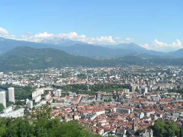
As a reward you can enjoy a remarkable view from the fortress.
There are steepness measurements and some oneliners written on the road, so you don't feel alone with your pain. The first oneliner is: "Why?". Try to find and answer :-)
As a reward you can enjoy a remarkable view from the fortress.
Tour gallery
Tour map and elevation profile
Minimum height 221 m
Maximum height 499 m
More about the tour author

|
azzie |
Comments

The climb starts east from the fortress at La Tronche. Do NOT use the "bubbles" :-)
GPS tracks
Trackpoints-
GPX / Garmin Map Source (gpx) download
-
TCX / Garmin Training Center® (tcx) download
-
CRS / Garmin Training Center® (crs) download
-
Google Earth (kml) download
-
G7ToWin (g7t) download
-
TTQV (trk) download
-
Overlay (ovl) download
-
Fugawi (txt) download
-
Kompass (DAV) Track (tk) download
-
Track data sheet (pdf) download
-
Original file of the author (gpx) download
More about the tour author
|
|
azzie |
Add to my favorites
Remove from my favorites
Edit tags
Open track
My score
Rate