Login

Forgot your login?

Cookies have to be accepted!
Your browser's cookie functionality is disabled. Please enable this functionality.

Not a member yet?

Register now
Login

Available for registred users only

Log in to use this feature.

Forgot your login?

Cookies have to be accepted!
Your browser's cookie functionality is disabled. Please enable this functionality.

Not a member yet?

Register now
Filter
Categories
Advanced filters
  • Distance (km)
  • Height
Save filters Reset filter

TrackRank

QRCode

Technical data

Distance11,1 km Height479 m Way down478 m Duration03:30 h:m Date31.01.2021
Scores Author Landscape Fun factor Fitness Technique

Statistics

316 Views Scores 13 Downloads Average
Rate
  • Track data sheet
  • Directions
  • Downloads
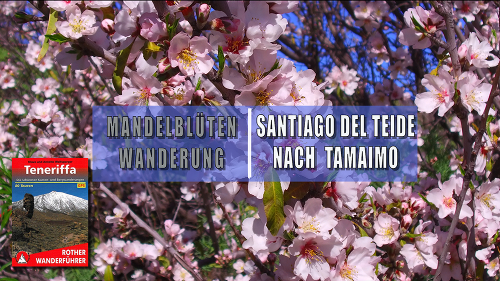
Sehr lohnenswert ist die Wanderung zwischen Januar und März, wenn die Mandelbäume blühen. Durch den Barranco de Santiago gelangen wir Tamaimo, steigen dann an blühenden Mandelbäumen vorbei zur Ortschaft Arguayo hinauf. Nach einem weiteren Anstieg zum Róque Arguayo geht es wieder Abwärts zum Ausgangspunkt.

Tour gallery

Tour map and elevation profile

  • Open Street Map
  • Google
Minimum height 570 m Maximum height 998 m Detailed view

More about the tour author

schleidy
Member since 2013

Send private message

Comments

GPS tracks

Trackpoints
  • GPX / Garmin Map Source (gpx) download
  • TCX / Garmin Training Center® (tcx) download
  • CRS / Garmin Training Center® (crs) download
  • Google Earth (kml) download
  • G7ToWin (g7t) download
  • TTQV (trk) download
  • Overlay (ovl) download
  • Fugawi (txt) download
  • Kompass (DAV) Track (tk) download
  • Track data sheet (pdf) download
  • Original file of the author (gpx) download

More about the tour author

schleidy
Member since 2013

Send private message
Share track
Add to my favorites
Remove from my favorites
Edit tags
My score
Rate
Track: Von Santiago del Teide nach Tamaimo
Type: Hiking
Distance: 11,1 km
Evaluated on:
Duration:
Day(s)
Hour(s)
Minute(s)
Score: Landscape Fun factor Fitness Technique