Login

Forgot your login?

Cookies have to be accepted!
Your browser's cookie functionality is disabled. Please enable this functionality.

Not a member yet?

Register now
Login

Available for registred users only

Log in to use this feature.

Forgot your login?

Cookies have to be accepted!
Your browser's cookie functionality is disabled. Please enable this functionality.

Not a member yet?

Register now
Filter
Categories
Advanced filters
  • Distance (km)
  • Height
Save filters Reset filter

TrackRank

QRCode

Technical data

Distance27,1 km Height535 m Way down527 m Duration00:00 h:m Date06.06.2021
Scores Author Landscape Fun factor Fitness Technique

Statistics

135 Views Scores 10 Downloads Average
Rate
  • Track data sheet
  • Directions
  • Downloads
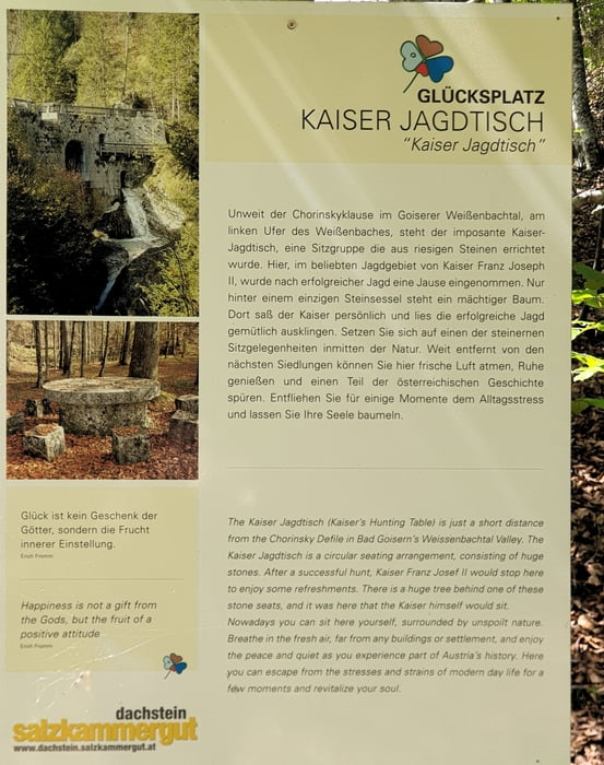
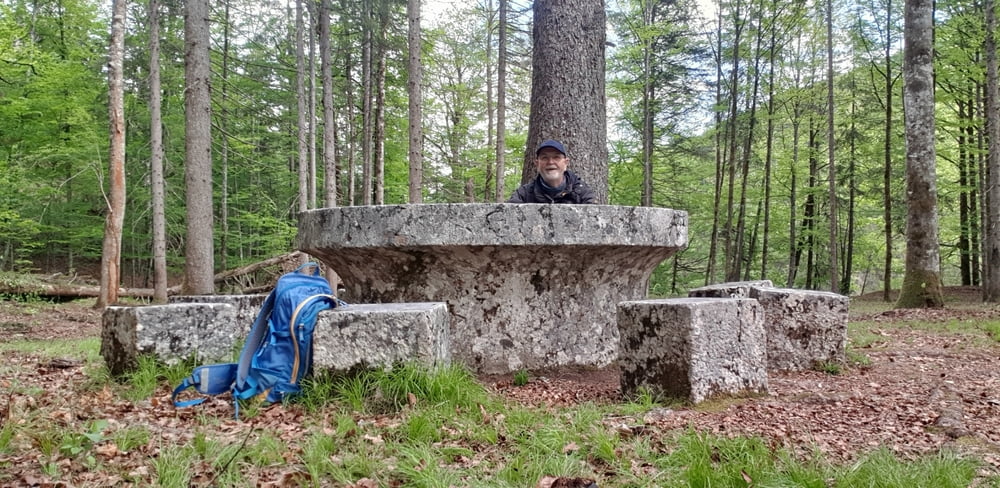
Die nicht sehr schwierige MTB Tour führt im Weissenbachtal durchwegs auf Forstwegen. Bei der Chorinsky Klause gibt es einen Rastplatz des Kaisers Franz Josef. Bei der Hinfahrt aus Bad Ischl kommend, bin ich irrtümlich  bei Lauffen eine Fußweg gefahren. Die Route beim Rückweg müsste passen.

Tour gallery

Tour map and elevation profile

  • Open Street Map
  • Google
Minimum height 465 m Maximum height 728 m Detailed view

More about the tour author

gabo16
Member since 2016

Send private message

Comments

GPS tracks

Trackpoints
  • GPX / Garmin Map Source (gpx) download
  • TCX / Garmin Training Center® (tcx) download
  • CRS / Garmin Training Center® (crs) download
  • Google Earth (kml) download
  • G7ToWin (g7t) download
  • TTQV (trk) download
  • Overlay (ovl) download
  • Fugawi (txt) download
  • Kompass (DAV) Track (tk) download
  • Track data sheet (pdf) download
  • Original file of the author (gpx) download

More about the tour author

gabo16
Member since 2016

Send private message
Share track
Add to my favorites
Remove from my favorites
Edit tags
My score
Rate
Track: Bad Ischl Weißenbachtal bei Lauffen
Type: Trekkingbike
Distance: 27,1 km
Evaluated on:
Duration:
Day(s)
Hour(s)
Minute(s)
Score: Landscape Fun factor Fitness Technique