Login

Forgot your login?

Cookies have to be accepted!
Your browser's cookie functionality is disabled. Please enable this functionality.

Not a member yet?

Register now
Login

Available for registred users only

Log in to use this feature.

Forgot your login?

Cookies have to be accepted!
Your browser's cookie functionality is disabled. Please enable this functionality.

Not a member yet?

Register now
Filter
Categories
Advanced filters
  • Distance (km)
  • Height
Save filters Reset filter

TrackRank

QRCode

Technical data

Distance46,0 km Height772 m Way down775 m Duration00:00 h:m Date06.06.2021
Scores Author Landscape Fun factor Fitness Technique

Statistics

288 Views Scores 33 Downloads Average
Rate
  • Track data sheet
  • Directions
  • Downloads
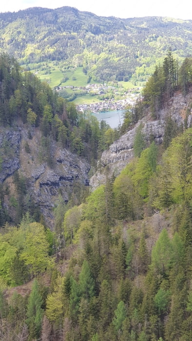
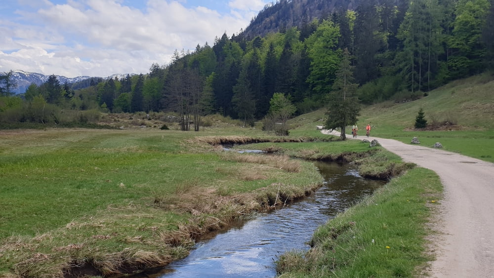
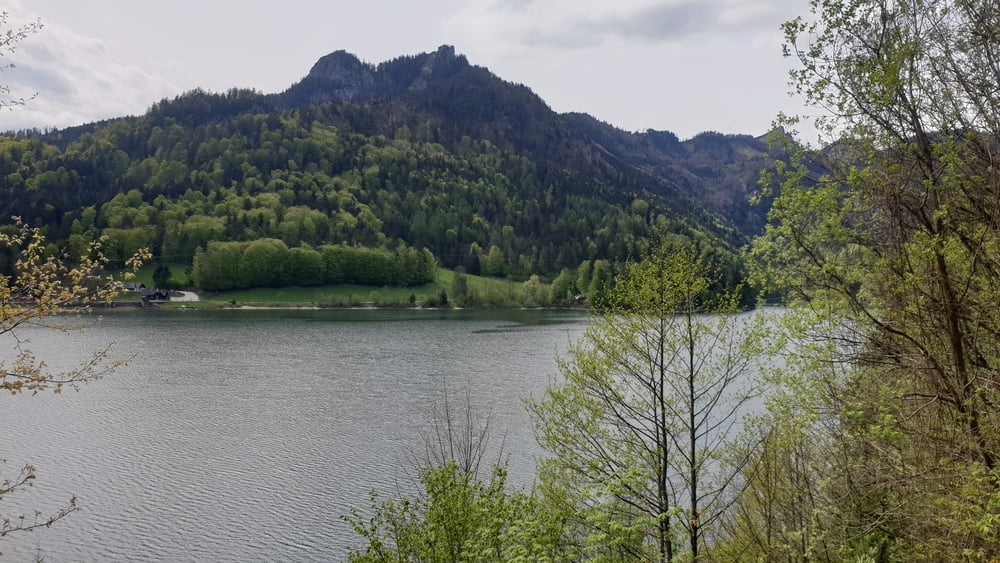
Eine schöne Runde von Ischl nach Weißenbach am Attersee bei Burgau in die Berge mit überwältigenden Aussichten auf den Attersee. Über eine idyllische Alm zum Schwarzensee und zurück nach Bad Ischl. Bitte in Pfandl, kurz vor Bad Ischl nicht den Fußweg versuchen, da kommen Stiegen.

Tour gallery

Tour map and elevation profile

  • Open Street Map
  • Google
Minimum height 453 m Maximum height 852 m Detailed view

More about the tour author

gabo16
Member since 2016

Send private message

Comments

GPS tracks

Trackpoints
  • GPX / Garmin Map Source (gpx) download
  • TCX / Garmin Training Center® (tcx) download
  • CRS / Garmin Training Center® (crs) download
  • Google Earth (kml) download
  • G7ToWin (g7t) download
  • TTQV (trk) download
  • Overlay (ovl) download
  • Fugawi (txt) download
  • Kompass (DAV) Track (tk) download
  • Track data sheet (pdf) download
  • Original file of the author (gpx) download

More about the tour author

gabo16
Member since 2016

Send private message
Share track
Add to my favorites
Remove from my favorites
Edit tags
My score
Rate
Track: Bad Ischl - Burgauklamm - Schwarzensee - Bad Ischl
Type: Mountain bike
Distance: 46,0 km
Evaluated on:
Duration:
Day(s)
Hour(s)
Minute(s)
Score: Landscape Fun factor Fitness Technique