


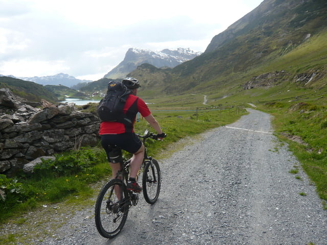
Start ist beim Hotel Zerres in Partenen. Dann geht es über die 32 Kehr der Silvrettastrasse bis hinauf auf die Bieler Höhe. Danach runter nach Galtür. In Galtür angekommen zweigen wir rechts ab und fahren ins Jamtal. Über eine gleichmässig steigende Schotterstrasse geht es bis zur Jamtalhütte. Lediglich kurz vor der Hütte wird´s noch richtig steil.
Retour geht´s denselben Weg bis nach Galtür. Vor Wirl (einem Ortsteil von Galtür) zweigen wir dann allerdings rechts ab und fahren über die alte Zeinisstrasse hinauf zum Zeinisjoch und weiter bis nach Kops.
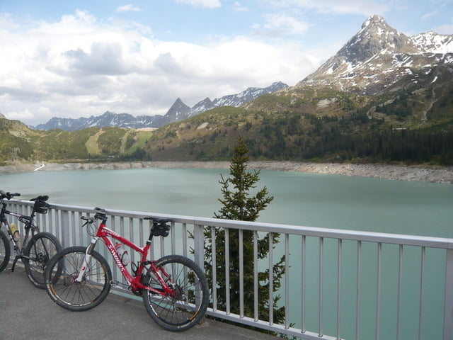
Danach geht es eine recht steile und kurvige Strasse hinunter und zurück nach Partenen.
Landschaftlich eine ganz tolle aber auch anstrengende Tour.
Tour gallery
Tour map and elevation profile
Minimum height 1039 m
Maximum height 2174 m
More about the tour author
|
|
Gueni |
Comments

GPS tracks
Trackpoints-
GPX / Garmin Map Source (gpx) download
-
TCX / Garmin Training Center® (tcx) download
-
CRS / Garmin Training Center® (crs) download
-
Google Earth (kml) download
-
G7ToWin (g7t) download
-
TTQV (trk) download
-
Overlay (ovl) download
-
Fugawi (txt) download
-
Kompass (DAV) Track (tk) download
-
Track data sheet (pdf) download
-
Original file of the author (gpx) download
More about the tour author
|
|
Gueni |
Add to my favorites
Remove from my favorites
Edit tags
Open track
My score
Rate