

Währinger Steig (B, C)
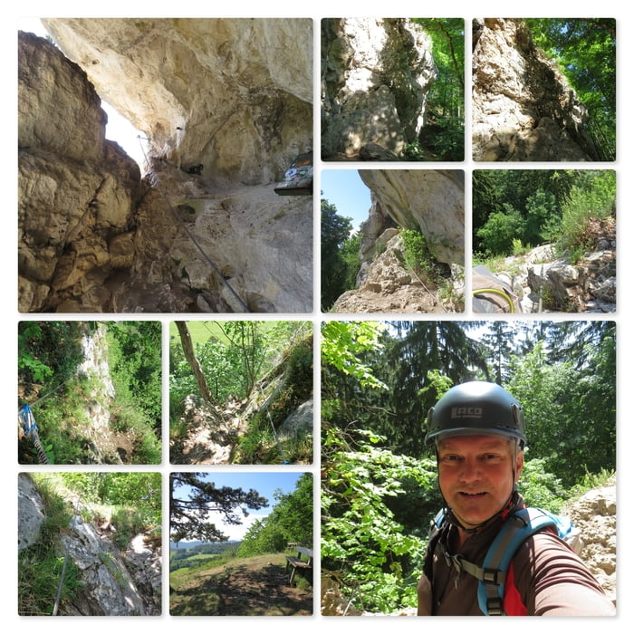
An der senkrechten Wand erkennt man sofort die Steig-Tafel, das Sicherungsseil und die Klammern im Felsen. Zuerst geht es senkrecht nach oben, dann etwas nach rechts bis zur Querung. Dort ist genug Platz für eine Pause und einige Fotos. Die Baumleiterhöle befindet sich ebenfalls an dieser Stelle.
Nach der Querung kommt der Durchschlupf zur Leiter.
Anmerkung: Da ist ein großer Schritt erforderlich, der für Kinder grenzwertig sein kann.
Diese geht es nun einige Meter senkrecht nach oben und dann wieder über ein gesichertes aber steiles Stück hinauf bis zum baldigen Ausstieg.
Oben angekommen setze ich mich auf das Bankerl und genieße die schöne Aussicht.
Further information at
http://www.volki.at/berge/hw/hw.shtmlTour map and elevation profile
Minimum height 596 m
Maximum height 619 m
Comments

Parkplatz am Sportplatz in Dreistätten, an den Koordinaten: N47° 51' 18.1" E16° 05' 58.6"
GPS tracks
Trackpoints-
GPX / Garmin Map Source (gpx) download
-
TCX / Garmin Training Center® (tcx) download
-
CRS / Garmin Training Center® (crs) download
-
Google Earth (kml) download
-
G7ToWin (g7t) download
-
TTQV (trk) download
-
Overlay (ovl) download
-
Fugawi (txt) download
-
Kompass (DAV) Track (tk) download
-
Track data sheet (pdf) download
-
Original file of the author (gpx) download
Add to my favorites
Remove from my favorites
Edit tags
Open track
My score
Rate