Login

Forgotten password?

Cookies have to be accepted!
Your browser's cookie functionality is disabled. Please enable this functionality.

Not a member yet?

Register now
Login

Available for registred users only

Log in to use this feature.

Forgotten password?

Cookies have to be accepted!
Your browser's cookie functionality is disabled. Please enable this functionality.

Not a member yet?

Register now
Filter
Categories
Advanced filters
  • Distance (km)
  • Height
Save filters Reset filter

TrackRank

QRCode

Technical data

Distance14,8 km Height405 m Way down519 m Duration06:30 h:m Date28.05.2021
Scores Author Landscape Fun factor Fitness Technique

Statistics

76 Views Scores 1 Download Average
Rate
  • Track data sheet
  • Directions
  • Downloads
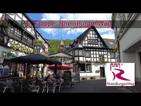
Heute lassen wir die Vulkaneifel hinter uns und unternehmen einen Abstecher an die Mosel! Zuvor wollen wir uns aber keinesfalls, dass Naturdenkmal der Baumallee am Karmelenberg sowie den Karmelenberg selber entgehen lassen. Am Ende der Etappe begrüßen uns dann die sonnigen Weinberge der Mosel.

Tour gallery

Tour map and elevation profile

  • Open Street Map
  • Google
Minimum height 76 m Maximum height 288 m Detailed view

More about the tour author

schleidy
Member since 2013

Send private message

Comments

GPS tracks

Trackpoints
  • GPX / Garmin Map Source (gpx) download
  • TCX / Garmin Training Center® (tcx) download
  • CRS / Garmin Training Center® (crs) download
  • Google Earth (kml) download
  • G7ToWin (g7t) download
  • TTQV (trk) download
  • Overlay (ovl) download
  • Fugawi (txt) download
  • Kompass (DAV) Track (tk) download
  • Track data sheet (pdf) download
  • Original file of the author (gpx) download

More about the tour author

schleidy
Member since 2013

Send private message
Share track
Add to my favorites
Remove from my favorites
Edit tags
My score
Rate
Track: 5. Etappe RBW: Bassenheim - Winningen
Type: Hiking
Distance: 14,8 km
Evaluated on:
Duration:
Day(s)
Hour(s)
Minute(s)
Score: Landscape Fun factor Fitness Technique