


- Holzkirchen Bahnhof (N47 53.049 E11 41.809 / 684 m)
- Winkel (N47 52.576 E11 40.274 / 704 m)
- Roggersdorf (N47 52.939 E11 40.011 / 705 m)
- Teufelsgraben (N47 52.574 E11 39.291 / 669 m)
- Teufelsgraben (N47 51.613 E11 38.852 / 675 m)
- Beim Hackensee (Nähe Kleinhartpennig) (N47 50.867 E11 38.850 / 696 m)
- Weiher (N47 50.785 E11 38.145 / 687 m)
- Schwarzes Kreuz (N47 49.994 E11 37.106 / 759 m)
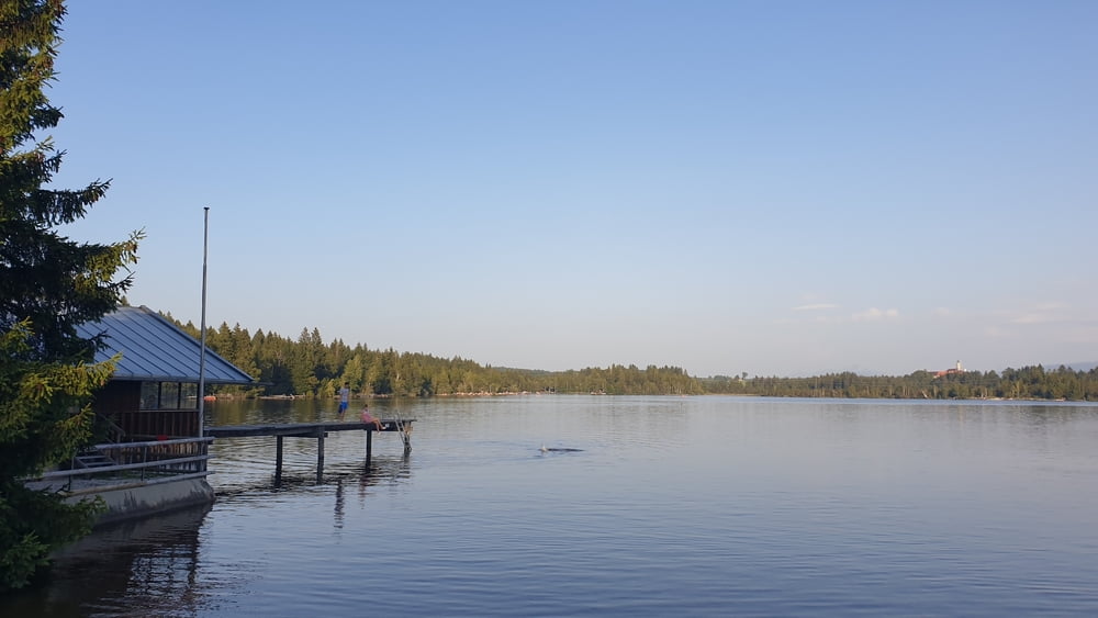
- Kirchsee (N47 49.257 E11 37.014 / 704 m)
- Köglsberg (N47 49.524 E11 38.303 / 698 m)
- Reith (N47 49.839 E11 38.768 / 730 m)
- Asperg (N47 50.653 E11 39.439 / 751 m)
- Kleinghartpenning (N47 50.874 E11 39.387 / 737 m)
- Buch (N47 51.407 E11 39.405 / 718 m)
- Baumgarten (N47 52.025 E11 40.445 / 709 m)
- Holzkirchen Bahnhof (N47 53.049 E11 41.809 / 684 m)
- Winkel (N47 52.576 E11 40.274 / 704 m)
- Roggersdorf (N47 52.939 E11 40.011 / 705 m)
- Teufelsgraben (N47 52.574 E11 39.291 / 669 m)
- Teufelsgraben (N47 51.613 E11 38.852 / 675 m)
- Beim Hackensee (Nähe Kleinhartpennig) (N47 50.867 E11 38.850 / 696 m)
- Weiher (N47 50.785 E11 38.145 / 687 m)
- Schwarzes Kreuz (N47 49.994 E11 37.106 / 759 m)
- Kirchsee (N47 49.257 E11 37.014 / 704 m)
- Köglsberg (N47 49.524 E11 38.303 / 698 m)
- Reith (N47 49.839 E11 38.768 / 730 m)
- Asperg (N47 50.653 E11 39.439 / 751 m)
- Kleinghartpenning (N47 50.874 E11 39.387 / 737 m)
- Buch (N47 51.407 E11 39.405 / 718 m)
- Baumgarten (N47 52.025 E11 40.445 / 709 m)
- Holzkirchen Bahnhof (N47 53.049 E11 41.809 / 684 m)
Tour gallery

Tour map and elevation profile
Minimum height 670 m
Maximum height 762 m
More about the tour author

|
Comments

Von München über die A8 bis zur Ausfahrt Holzkirchen fahren und von der Autobahn abfahren. Dann kurz der B318 in Richtung Tegerensee folgen und an der dritten Ausfahrt von dieser abfahren. Nun der Misbacher Straße bis nach Holzkirchen folgen und durch den Ort bis zum Bahnhof fahren. Am Bahnhof kann das Auto auf dem kostenpflichtigen Parkplatz abgestellt werden.
GPS tracks
Trackpoints-
GPX / Garmin Map Source (gpx) download
-
TCX / Garmin Training Center® (tcx) download
-
CRS / Garmin Training Center® (crs) download
-
Google Earth (kml) download
-
G7ToWin (g7t) download
-
TTQV (trk) download
-
Overlay (ovl) download
-
Fugawi (txt) download
-
Kompass (DAV) Track (tk) download
-
Track data sheet (pdf) download
-
Original file of the author (tcx) download
More about the tour author
|
|
Add to my favorites
Remove from my favorites
Edit tags
Open track
My score
Rate