
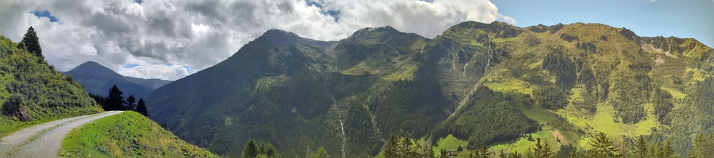

Eine schöne Panoramatour, obwohl der Asphaltanteil leider hoch ist, östlich von Innsbruck.
Straße nach Wattenberg und dann kurz vorm Gasthaus Haneburger auf Schotter links rauf zur Poversalm (wie es die Einheimischen schreiben, auf der Tafel: Pofers). Da kann man angeblich auch einkehren. Weiter mit schönen Ausblicken auf offiz. MTB Weg. Beim Wegpunkt unbedingt links runter! Das Lebensgefahr-Schild hab ich erst retour gesehen... Im GH Säge bin ich kurz eingekehrt, sehr freundlich. Beim Volderwildbad biege ich rechts ab. Von da ginge es weiter zur Voldertalhütte bzw zur Steinkaseralm. Ich bin dann gemütlich über die Dörfer Tulfes, Rinn zurück nach IBk gerollt.
Tour gallery


Tour map and elevation profile
Minimum height 553 m
Maximum height 1940 m
More about the tour author
|
|
mitter |
Comments

Start und Ziel in IBK Wilten.
GPS tracks
Trackpoints-
GPX / Garmin Map Source (gpx) download
-
TCX / Garmin Training Center® (tcx) download
-
CRS / Garmin Training Center® (crs) download
-
Google Earth (kml) download
-
G7ToWin (g7t) download
-
TTQV (trk) download
-
Overlay (ovl) download
-
Fugawi (txt) download
-
Kompass (DAV) Track (tk) download
-
Track data sheet (pdf) download
-
Original file of the author (gpx) download
More about the tour author
|
|
mitter |
Add to my favorites
Remove from my favorites
Edit tags
Open track
My score
Rate