Login

Forgot your login?

Cookies have to be accepted!
Your browser's cookie functionality is disabled. Please enable this functionality.

Not a member yet?

Register now
Login

Available for registred users only

Log in to use this feature.

Forgot your login?

Cookies have to be accepted!
Your browser's cookie functionality is disabled. Please enable this functionality.

Not a member yet?

Register now
Filter
Categories
Advanced filters
  • Distance (km)
  • Height
Save filters Reset filter

TrackRank

QRCode

Technical data

Distance8,8 km Height219 m Way down217 m Duration03:00 h:m Date04.10.2020
Scores Author Landscape Fun factor Fitness Technique

Statistics

70 Views Scores 2 Downloads Average
Rate
  • Track data sheet
  • Directions
  • Downloads

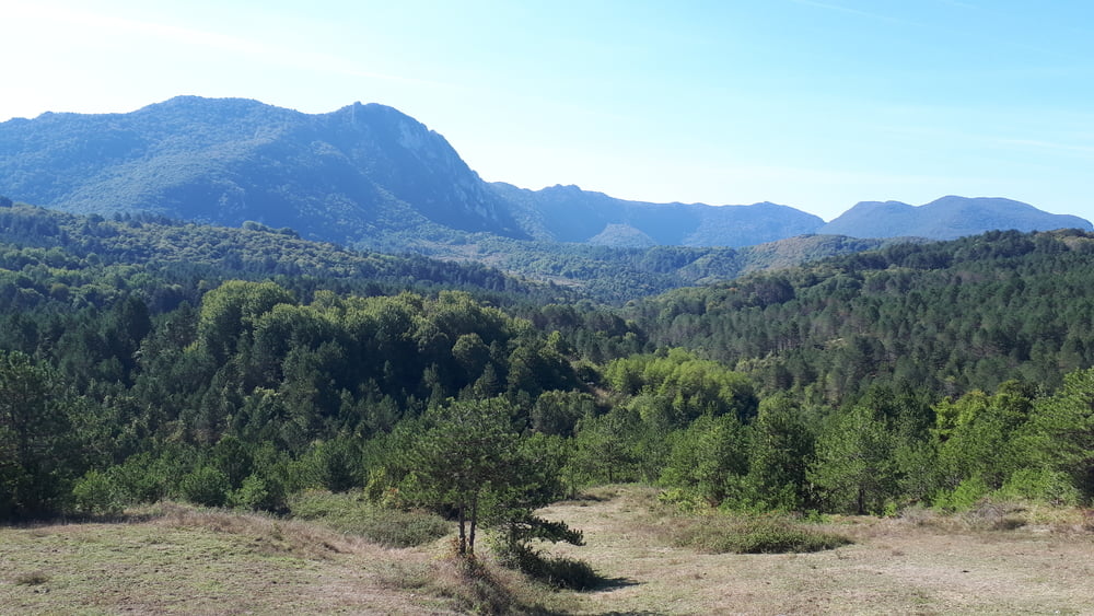
Sehr schöne kleine Wanderung im Hinterland bei Cide.

Wir sind mit dem Auto zum Startpunkt gehfahren und haben dann eine 10 km-Runde durch schöne Landschaft und kleine Dörfer bzw. Bauerhöfe erlaufen.

Im Somme unbedingt Getränke mitnehmen!

Tour gallery

Tour map and elevation profile

  • Open Street Map
  • Google
Minimum height 115 m Maximum height 275 m Detailed view

More about the tour author

Zoellig
Member since 2009

Send private message

Comments

GPS tracks

Trackpoints
  • GPX / Garmin Map Source (gpx) download
  • TCX / Garmin Training Center® (tcx) download
  • CRS / Garmin Training Center® (crs) download
  • Google Earth (kml) download
  • G7ToWin (g7t) download
  • TTQV (trk) download
  • Overlay (ovl) download
  • Fugawi (txt) download
  • Kompass (DAV) Track (tk) download
  • Track data sheet (pdf) download
  • Original file of the author (gpx) download

More about the tour author

Zoellig
Member since 2009

Send private message
Share track
Add to my favorites
Remove from my favorites
Edit tags
My score
Rate
Track: Dorfrunde bei Kumluca/Cide (10 km)
Type: Hiking
Distance: 8,8 km
Evaluated on:
Duration:
Day(s)
Hour(s)
Minute(s)
Score: Landscape Fun factor Fitness Technique