


Ausgangspunkt der Tour ist der Standort Wildeck-Raßdorf Richtung Wildecker-Forst direkt hinder der Autobahn. Dort gibt es Parkmöglichkeiten für Autos.
Zunächst geht es Richtung Hönebach parallel zur Autobahn - dann quer über eine Wiese in den Wald - anfangs schöner Trail im Schatten - weicher Waldboden - Wurzeln usw.
später tiefe Rillen durch Rückefahrzeuge - teilweise echtes Abenteuer!
Große Kreuzung ist dann der "Holzbahnhof" - heisst wirklich so.
Dann Schotterwege quer durch die Prärie.
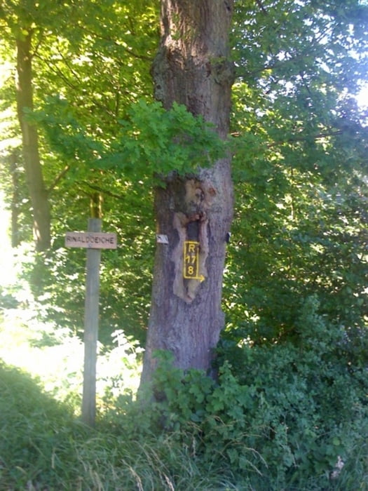
Vorbei an Lipskyeiche, Rinaldoeiche, Bäreneiche, zur Franzoseneiche ist ein klasse Trail - Gebüsch - Hecken - schmaler Wildwechselpfad, Wurzeln, usw.
Anschließend den Höhenweg weiter - Kreuzung Heiligenstock - Richtung Ruine Blumenstein - weiter zum Ausgangspunkt der Rundtour.
Tour gallery


Tour map and elevation profile
Minimum height 221 m
Maximum height 476 m
More about the tour author
|
|
mweber |
Comments

Ausgangspunkt der Tour ist der Standort Wildeck-Raßdorf Richtung Wildecker-Forst direkt hinder der Autobahn. Dort gibt es Parkmöglichkeiten für Autos.
GPS tracks
Trackpoints-
GPX / Garmin Map Source (gpx) download
-
TCX / Garmin Training Center® (tcx) download
-
CRS / Garmin Training Center® (crs) download
-
Google Earth (kml) download
-
G7ToWin (g7t) download
-
TTQV (trk) download
-
Overlay (ovl) download
-
Fugawi (txt) download
-
Kompass (DAV) Track (tk) download
-
Track data sheet (pdf) download
-
Original file of the author (gpx) download
More about the tour author
|
|
mweber |
Add to my favorites
Remove from my favorites
Edit tags
Open track
My score
Rate