Login

Forgot your login?

Cookies have to be accepted!
Your browser's cookie functionality is disabled. Please enable this functionality.

Not a member yet?

Register now
Login

Available for registred users only

Log in to use this feature.

Forgot your login?

Cookies have to be accepted!
Your browser's cookie functionality is disabled. Please enable this functionality.

Not a member yet?

Register now
Filter
Categories
Advanced filters
  • Distance (km)
  • Height
Save filters Reset filter

TrackRank

QRCode

Technical data

Distance11,8 km Height382 m Way down377 m Duration01:15 h:m Date08.04.2022
Scores Author Landscape Fun factor Fitness Technique

Statistics

205 Views Scores 26 Downloads Average
Rate
  • Track data sheet
  • Directions
  • Downloads
  • Start: Marina di Campo.
  • Ziel: Lacona.
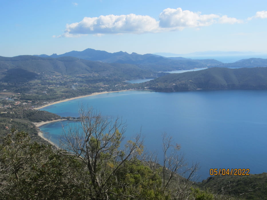
  • Aufstieg zum Monte Tambone(höchster Punkt) auf teils steiniger, stellenweise steiler Forststrasse. Mit dem E-Mtb kein Problem.
  • Vom Monte Tambone auf spassigem S2 Trail talwärts. Das letzte Teilstück auf steinigem Forstweg S1.

Tour map and elevation profile

  • Open Street Map
  • Google
Minimum height 134 m Maximum height 472 m Detailed view

More about the tour author

MargesinFriedrich
Member since 2012

Send private message

Comments

GPS tracks

Trackpoints
  • GPX / Garmin Map Source (gpx) download
  • TCX / Garmin Training Center® (tcx) download
  • CRS / Garmin Training Center® (crs) download
  • Google Earth (kml) download
  • G7ToWin (g7t) download
  • TTQV (trk) download
  • Overlay (ovl) download
  • Fugawi (txt) download
  • Kompass (DAV) Track (tk) download
  • Track data sheet (pdf) download
  • Original file of the author (gpx) download

More about the tour author

MargesinFriedrich
Member since 2012

Send private message
Share track
Add to my favorites
Remove from my favorites
Edit tags
My score
Rate
Track: Marina di Campo-Monte Tambone-Trail nach Lacona.
Type: Mountain bike
Distance: 11,8 km
Evaluated on:
Duration:
Day(s)
Hour(s)
Minute(s)
Score: Landscape Fun factor Fitness Technique